Western Virginia and Pennsylvania Through Central Indiana and Illinois 2011

Unlike our trip out West in 2010 that took months of planning this trip was “born” while talking after dinner during our trip to Columbia, SC and Lake Wateree, SC in June 2011. Steve had bought property in 2007 at the Twin Rivers subdivision of Ashton, Idaho for his retirement home. Then we were reacquainted and as they say that’s the rest of the story. So the land went on the market and the economy went in the toilet. Since this area is mostly farmland and summer homes nothing was selling and prices had crashed. We couldn’t sell it for what we owed. By 2012 we either had to pay it off, refinance and keep paying for something we weren’t using or convert to a construction loan. Our decision was to build but spend the hard winter months in our RV someplace WARM!!! After all you can’t expect a southern transplant of 40 years to get her Yankee corpuscles back that fast!

 We began researching home plans and found one that met our needs. It will be a raised ranch style plan. At first we wanted a log home. The price quickly made that not feasible. We decided on a frame home with log siding and log accents. Through a neighbor in Idaho we were referred to a builder. After phone calls and e-mails with him we felt comfortable in our choice and decided to make a trip to Idaho to get the process started. Now many folks would have flown out or driven in a straight line. Not us. We meandered along for 3 weeks and took in sights along the way. So back for your entertainment by popular demand (well one person asked for it) is our blog. (I’ve put my thoughts and some after the fact comments in green. Chari)  Steve will comment in blue.

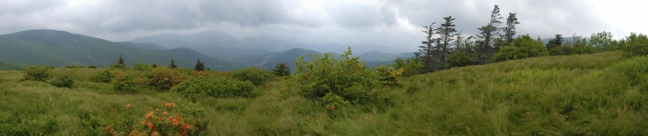
Claytor Lake in Bloom

We left Charlotte, NC on August 8, 2011 with temperatures in the high 90’s and humidity to match. Our first stop would be Claytor Lake in Virginia. We’ve driven to Pennsylvania through western Virginia along I- 81 often and said “we need to stop at Claytor Lake sometime” A few days at the lake in the hot humid weather was just perfect. RV sites with electric and water are not reservable. When we got there the best sites were taken and unlike most state parks where sites are well spread out, these resembled commercial parks where sites are close together and minimally shaded. The non-electrical sites were in an older section with full shade and private. If we ever go at another time of year, that’s where we’ll stay. When we arrived it was still hot and sticky. Then there came a thunderstorm and a drastic change in the weather. The next four days were perfect summer weather with moderate humidity. It felt wonderful. We hung out at the campsite the first day as Opal wasn’t feeling well. She’d had too many spare rib bones two nights before. Bad dog parents! The campground host came by that afternoon as we sat under thawning reading and asked “haven’t you folks moved since getting here?” We had taken several walks and a drive that day. We found a small local history society museum called The Wilderness Road Museum. It was dedicated to local history and the westward expansion along the Wilderness Road used by pioneers including Daniel Boone.

A Secluded Cove on Claytor Lake

By Wednesday Opal was OK so we headed off to kayak. The boat ramp was thickly covered in algae. Chari remember thinking “I need to be very careful. This is going to be very slippery” No sooner had I completed that thought than my feet were in the air and above my head. Steve said it looked like a cartoon. Down she came on the cement. It literally knocked the wind out of her. Steve was really scared. When I regained my breath and could talk it seemed that I was all right. I had 2 swollen areas on my hands (hematomas), a small, deep cut on my left elbow but could move without pain. I had bruised my left ribs. The safety vest I wear when boating had cushioned the fall. I was thankful I had no serious injuries. Another of my nine lives used up!  Once she crawled off the algae and checked again we moved off the ramp to a dirt launch site. We had a good paddle. The lake has lots of development beyond the park boundaries. We found a secluded cove and an old boat dock partially submergered where we sat in the shade for a while. A few days later it would become obvious that I had broken a rib or two and chipped my elbow. You probably wonder how I could kayak with a broken rib. It didn’t hurt doing while paddling but bending over to put on shoes or changing position in bed well that was another matter. It took about three weeks before I could move without grimacing. The lake was beautiful and we had three good paddle trips. Arrowhead, buttonbush and daisies were blooming all over. In the evening Opal, the three of us would take long walks to the beach after swimming hours. We coaxed Opal into the water. This is the dog who is scared of any moving water. When she finally got her tummy wet it was a celebration. On the last night we were run off the beach along with at least six other dogs and their owners. It seems it is illegal for dogs to be on swim beaches in Virginia. (As Steve was working on a book about the trip to Utah last year at www.Blurb.com, he mentioned that there seemed to be a bad trend developing. He pointed to the fall I’d taken in the trailer in Missouri and said “you need to stop having injuries at the start of our trips”)

 From August 12-18 we visited with Steve’s sister in Chambersburg, PA trying to help out  a bit while other family members had surgery. We did take one day to tour Gettysburg National Battlefield. Two years ago we’d stopped at theVisitors Center and had seen the diorama but didn’t have time to do the tour. Since then we’ve watched the movie “Gettysburg” and Steve has read Shelby Foote’s account. Standing at the site of Devil’s Den we could picture the fear and courage of attacking troops holding the higher ground. The open field below Little Round Top was the site of Pickett’s Charge. I’d love to be there for the 150th anniversary re-enactment in 2013 but we’ll be out west by then. It’s interesting to see how close the turn of events were here. You can’t help thinking what would have happened if Lee had been victorious. Once everyone was recuperating well we headed off to some sightseeing in western Pennsylvania.

Gettysburg National Cemetery

Famous Address Given Near Cemetery

Example of Monuments at Gettysburg National Battlefield

For Three Days in July 1863 ...

Looking Down From Devil's Den

Neither of us had spent any time in the area known as the Laurel Highlands. We had decided to make reservations on a stop by stop basis for this trip. For this segment we’d stay at Blue Knob State Park. We had a nicely wooded site with electricity and water from the RV tank. The weather continued cool and pleasant. There were some good trails for walking Opal very near by. This started my 2-3 mile/ day walks through out the trip. Why I don’t keep it up at home I don’t know. I always feel better when I do.

View From Blue Knob

 After setting up the RV we took off to explore some back roads. US Route 30 (the Lincoln Highway) runs through Chambersburg and through this area. It is the first east-west road running coast to coast.  The road began with the development of the Forbes Trail (named for General John Forbes) and was used to move troops west during the French and Indian Wars 1754-60. Later it became a major route as settlers moved into western Pennsylvania and further west. With the American love of the automobile this route has a legacy and fan following similar to Route 66. We located a barn decorated on three sides with a mural depicting the history of US 30.

Celebrating Highway US 30

Lincoln Highway Barn Mural

Weathered PA Barn

History in the Graveyard

The Other Side of the Mural

Gas Pump Mural of the Lincoln Highway

On our way to the park the road passed through rolling hills and we’d noticed some very photogenic barns. We hoped to find some on our own… and we did. We found a log church dating from 1806 surrounded by a cemetery and a covered bridge with a barn nearby.  After taking church pics we only had a few minutes to look at the old gravestones before a thunderstorm chased us into the car. Go back and take a look at the US 30 barn mural and you will see the old log church shown on it. One caught our eye as it was the Consort of a man also buried there and next to his first wife. We found the grave of a second wife too. He was a very busy man! Another grave was marked on the back “published the first Bible west of the Allegheny Mountains” 

Child Bride

Old Log Church

Pennsylvania's Known for Covered Bridges

Flight 93 Memorial Temporary Museum

Concept Drawing for Completed Memorial

There were five sights we wanted to visit while in this area: the Flight 93 National Memorial, the Johnstown Flood National Memorial, Frank Lloyd Wright’s Fallingwater and the Allegheny Railway Portage NHS and Horseshoe Curve. The Flight 93 Memorial to honor those who gave their lives to prevent the 9/11 plane from reaching the capitol was still under construction. It was due to be dedicated in just a few weeks on the tenth anniversary of 9/11. At the time we were there you couldn’t walk down to read the names on the wall. Just being there and reading about the recovery was solemn enough. There will be a 40 bell chime tower built in the future. I’m sure we’ll return again. I overheard a ranger say that unlike most parks that have tours and activities the plans are to leave this site for quiet personal reflection.

Memorial Under Construction

The Johnstown Flood Museum National Memorial was something I’d known about for a long time but not in detail. We bought the CD version of David McCullough’s Johnstown Flood and played it after we toured the site. Being able to picture the events made the story that much more realistic. The perfect storm of failed engineering, above average rainfall and a town who’d become complacent to reports of dam failure led to the worst loss of life from flood in the history of the US. Over 2000 people were killed and a town essentially wiped off the map in a matter of hours. Now the valley looks green and peaceful. The museum is well done and the movie is a good overview of events. While there, we chatted with a ranger about photography. She gave us directions to a barn in the area still  sporting a Chew Mail Pouch Tobacco sign. We couldn’t resist this opportunity.

Chew Mail Pouch Barn

 Our next day was spent touring a site Steve and I had never heard about, the Allegheny Railroad Portage Museum. This is another NHS site. We grew up in NY State and learned about the Erie Canal and its impact on commerce and westward expansion. To compete with the Erie Canal, Pennsylvania constructed canals from Philadelphia west to the Allegheny Mountains and from Pittsburgh eastward. But how were they to get boats over the mountains? They constructed a clever system using 3 compartment boats which would be split into sections and hauled up over the mountains on railroad flatbed cars using a balanced pulley system and a steam engine. At first rope was used. It had a tendency to break with disastrous results. Then a braided cable was invented by the Roebling family. This is the same family who later built the Brooklyn Bridge. The Allegheny Portage Railroad operated for about 20 years until an engineering marvel called the Horseshoe Curve made it possible to get trains across the mountains. I found the museum fascinating both for an era of history I didn’t know anything about and for the engineering required. We continued on to Horseshoe Curve which is part of the National Railroad Museum (privately run) and a must for any railroad buff. The museum exhibits detail the construction and use of the curve. During World War II this was thought to be so vital to the US economy that a Nazi plan to destroy the curve was exposed. I want to read more about it. We rode the trolley up to view the curve and waited about 30 minutes. No train. We were about halfway down the steps back to the museum when we heard a train coming. Steve ran back up the steps to get a picture. I didn’t even try. Then another train started from the other direction. He photographed them crossing at the apex of the curve. The sad thing is that we think Steve dropped his camera digital card at a rest stop in South Dakota so unless it is hiding somewhere in car that picture will be in our mental album of the pictures that got away. So for this segment as of now, the pictures are mine. I’m glad to be able to add that we did find his photo card so many of the above photos are Steve’s.

Taking the Tram up to Horseshoe Curve


Train Entering Horshoe Curve

Trains Crossing on Horseshoe Curve

Our last day in western Pennsylvania took us to the southwest corner to see Frank Lloyd Wright’s Fallingwater. I’m a lover of the Arts and Crafts movement and have enjoyed many of Wright’s designs which were then ahead of their time and are now so commonly accepted. I’ve had an opportunity to tour his Biltmore Hotel in Phoenix, AZ and found it very informative. Going to Fallingwater has been on my Bucket List for a long time. When Fallingwater was built the idea of incorporating a home into the landscape was avante garde. The Kaufmann family (the father was a  department store magnet), owned the property as their weekend getaway. Their favorite place was the waterfall and they asked Wright to place the house near there. To their amazement, he designed it so the house was over the waterfall. Reservations are required to tour the home. We called in the AM and had no trouble getting a PM tour. However the busy months of May and October may require advance planning. This is because the grounds are exquisite. Many people come to see spring wildflowers or autumn color. All tours are in groups of about 10-12 and given by docents. All furniture and artwork is original to the home and is the only one of Wright’s homes to be open to the public with furnishings in tact. Wright designed furniture for its effect on the view rather than comfort. for example the sofas in the living room are very low so that you view an expanse of woods and sky. He was also a dealer in Asian art. Our docent mentioned he made more money trading in art than he did as an architect. One idea we hope to incorporate into our new home is a bookcase built against a wall along a stairway. The oddest thing we saw was a toilet that looked to be only 12” high, like a kid’s toilet but in an adult bathroom. Even as short as I am I’d have trouble using it. At least my feet would touch the ground! The classic photo of Fallingwater is taken from a viewpoint downstream. To reach this spot you walk to down a well maintained path for a quarter mile. It’s impossible to get a picture without people in it during tour hours. The grounds can be toured as well. They can be toured by themselves for a reduced rate. We added a hat pin and ornament to our collection. On the way back to camp we stopped to photograph a huge field of black-eyed susans we’d seen on our way in. We stayed until sunset. Realizing that it would be too late to cook when we got home, we stopped at a local cafe. Just good home cooking. The type of place Diners, Drive-ins and Dives might frequent.

Entrance to Fallingwater

Classic View of Fallingwater

Fallingwater Terrace

Under the House at Top of the Falls

Typical Wright Design


Chari in Black-eyed Susan Field

Above the Crowd


Evening Falls Over Black-eyed Susans

Now we move on through Ohio to Indiana. Our route on US 30 to I-80 took us across Ohio and into central Indiana. We can’t think of how many jokes we made about all of the black dirt along the way as that was all there was to see along I-80. there wasn’t anything else to see! We had made reservations at Cagles Mill Lake (Lieber State Recreation Area) for three nights.  Again we had electric hookup but only water from the RV tank. Sites were nicely shaded. The reason for stopping here was to visit with Chari’s cousin Judy in Terre Haute. We didn’t do any sightseeing this time, just visited. We looked through old pictures and Chari took several to scan. One was a picture of her maternal grandmother as a very young woman. She’d never seen her picture other than as an older woman. Judy also gave her a china head doll that had belonged to her mother so it’s over ninety years old. She’d given it to her aunt after her Mom passed away as a remembrance.  Her cousin had new clothes made for the doll and new hair put on. She was thrilled!  

Chari and Her Cousins, Easter 1955

The Falls at Cagles Mill

Her cousin still works part time so we took a few hours to explore the park area. While the falls at Cagles Mill were not flowing very fast in August, these are the highest falls in Indiana. We were going to do a scenic drive through an area of covered bridges but weather and time didn’t cooperate.

Who Says I'm Afraid of Water?

From Indiana we were off to western Illinois for a reunion with Chari’s roommate from her Air Force days (1968-1972). Betty and Chari shared an apartment together while stationed at Chanute AFB for about 2 years until Betty was transferred to Thailand and Chari to Oklahoma. They’ve stayed in touch all these years but hadn’t seen each other since 1975! Of course neither one of them had changed! This is one of those friendships that endures and you can pick right up regardless of the time between visits.

We stayed at Rockwood-Morrison State Park. The site had electric and we used RV water. Except for some very pesky mosquitoes at night it was a very good campground. There is a lake at the park so we did kayak one afternoon. We were surprised to find we’d come at a fantastic time. The lake was covered with blooming yellow lotus. We also were able to watch a green heron for an extended time and a blue heron. Chari was particularly pleased with one photo of the lotus taken did close-up with a flash.

Chari's Favorite Lotus Picture

Blue Heron and Lotus

Flowers, Flowers Everywhere

Chari Paddling at Rockwood-Morrison SP

Green Heron

Steve's Best Lotus Pic

Take Me to Your Leader

We also drove over to Dickson, Ill. which is the childhood home of Ronald Reagan. The home had fallen into severe disrepair and has now been restored beautifully by local volunteers. While we were on the tour and in the kitchen Chari noticed that the dishes his mother had were from a premium gift you could get when purchasing from the Jewel Tea Co. Her father had worked for Jewel Tea in the 1930’s (long before me – Chari) and my mother had the same pitcher and mixing bowl. I don’t know what happened to them. I should have kept them. Apparently they are now a collector’s item.

 Now for a long day’s drive across Iowa and southern Minnesota to eastern South Dakota. After a rest stop at an Iowa Visitor’s Center and an armful of brochures I spent several hours planning more trips.  We did stop along the way where I-90 crosses the Missouri River (the infamous rest stop…I’ll let Steve explain why) and saw some exhibits about the Lewis and Clark Corps of Discovery. We camped overnight at Vermillion Lake State Park. Since it was just a sleep and eat stop we didn’t even unhitch the trailer. We did take a nice long walk down to the lake and around the campground. After being in the car all day all three of us needed it. Vermillion Lake looks like a place we’d like to have time to paddle.  So shall I say for the first but not last time “When we come back” Steve said that he should put this saying on my tombstone “When I come back…” and bury me with all the travel brochures I’ve collected but not gotten to use in this lifetime. We met another couple at Vermillion Lake who like ourselves are newly retired and traveling the USA. They were on their way to the Tetons. They were from Michigan. When we told them our return route would take us through the Upper Peninsula and down to Grand Rapids, they suggested we plan on seeing Sleeping Bear Dunes National Seashore. Well, you don’t have to ask us twice!  So now that’s on the return trip.

 From here it was another long day to drive to Custer State Park in the South Dakota Black Hills. There’s so much to talk about there that we’ll take a break here and end Part 1. To be continued…..

Posted in History, Illinois, Indiana, kayaking, Narrative, nature, Pennsylvania, photography, travel, Travel USA, Virginia | Leave a comment

The Midlands of South Carolina

The area between the mountains and the coast in the Carolinas has been named the Piedmont in NC and the Midlands in South Carolina. In mid June 2011 we set out for a week to explore this area. While sitting under our awning one evening we would come to a decision that would dramatically change our lives.  More about that later.

Our camera club, Carolina Nature Photographers Association, has a sub group for those who enjoy non-motorized boating and photography. It was an outing with this group that brought us to the area. We’d made reservations at Sesquicentennial State Park which is just off I77 at Two Notch Road in Columbia, SC. I’d been to Columbia several times for day trips as it’s just two hours from Charlotte, NC. I’d never been to Sesquicentennial State Park. What a gem right in the heart of the city. It’s a large, wooded park with a small lake for boating and fishing. There are two loops of campsites in the campground each with electric and water service. We knew we’d be using the air conditioning as the past few days had brought the first ‘Carolina summer’ days with temperatures in the mid to upper 90s and humidity to match.

Sesquicentennial SP  was built in 1946 to celebrate the 150th anniversary of the founding of the city of Columbia. There’s an old home on the property and a dedication site explaning the history of the park. Locals just refer to it as “Sesqui”. Runners, bikers and dog walkers frequent this park.

After setting up we decided to hike one of the trails before dinner. Normally I’m coming along behind Steve but tonight I was in high gear and Steve lagging behind. I should have known something was up but chalked it off to a busy day of travel.

CNPA at Goodale SP June 2011

On Saturday we drove about 30 minutes south to Camden, SC and met the group at Goodale State Park. There is no camping facility here. It is a small park formed from an old Civil War era  mill and lake. The lake is the big draw here. If you don’t have your own kayak or canoe, you can rent one at the park office very inexpensively. I’ve lived in the Carolinas for 20 years and had never heard of this place. What a hidden gem! I’m sure it’s pretty all year long. As I write this I’m noting that the park is closed M-TH from Jan.1-March 14.

Floating Hearts

We hit it at the peak for waterlily and floating heart bloom. The lake offers a 3 mile canoe trail through cypress woods with the water plants dancing on the surface. It was a fairyland. There is also a 1.5 mile nature trail on the lakeshore known for it’s pitcher plants. We didn’t take the trail after lunch due to the high temperature. I’m told that the lake has it’s very own mascot alligator. We didn’t see any sign of him.

Spadderdock Reflection


Chari Enjoys Goodale Water Trail


Butterfly on floating Hearts

N R Goodale Canoe Trail
OK, so here we go again with a text size change! I’m obviously picking up the size from the pictures but I can’t figure out how to change it back. So we’ll live with it. ( I’ve just finished previewing the entry and find that the program seems to have fixed this problem in the final product.)
 
Sunday was another very hot day. By the time we met up with the group at 10AM at the Swan Lake Iris Gardens in Sumter, SC. it was 95 degrees. We knew this would be a short visit.
 
Swan Lake Iris Gardens is a public park and the only one in the country to have all 8 species of swan. There are ducks too. It was originally property of a local businessman who was attempting to landscape his home with Japanese irises. They had been planted like the bearded iris and had failed to thrive. So he had his gardner throw the plants into the pond. The next spring they bloomed beautifully. One of the largest collections of iris in the country was created by accident. We missed peak bloom period which is in May to early June so the spectacular shots eluded us. There are also numerous other blooming shrubs and cultivated gardens. We did find a school of catfish fry in one of the smaller inlets. By 12:30 everyone was drenched in sweat and too hot to stay any longer. 
 

Macro Image of Japanese Iris

Steve's Water Lily Pic


Catfish Fry


Daylillies at Swan Lake


Another Iris Close-up

Muscovie Duck

Photogenic Swan


If you are ever in the Sumter, SC area at Christmas do go to see the lighting display at the Swan lake Iris Gardens. They have over one million lights strung throughout the garden.
 
By mid afternoon Steve was beginning to feel ill. He would spend the
next two and a half days in bed with flu like symptoms. while Steve was sick I read a lot, walked Opal all over the park which was good for both of us. I couldn’t help noticing a family across the way. They were from Florida and travelled in one of those small trailers without windows like you use for ATVs. The three of them (and they were not small people) plus 2 dogs and a cat and all their gear fit in there. We couldn’t figure out how they did it. Must have been a very close family! We were scheduled to leave on Wednesday and spend another 4 days at Lake Wateree State Park.
 
 On Tuesday we decided that if he didn’t feel any better we’d go directly home and take him to the doctor. Fortunately he awoke on Wednesday morning feeling much improved but weak from ordeal. We checked in with the park office and were able to extend our stay by two more days. Our reservations at Lake Wateree also could be moved. So we spent Wednesday just hanging out at the trailer and taking Opal for some walks.
 

Bad Hair Day

We’d planned to go to the zoo in Columbia earlier in the week. Steve felt up to it so off we went. Riverbanks Zoo and Gardens is a well established zoo where many of our photo club members have taken prize winning shots in the captive category. Again it was in the mid nineties so we took our time going through the exhibits. We especially enjoyed the baboon family and the antics of the baby. One picture I took with them all sitting around looked like they were trying to teach him to play cards. I’ve called it “The Poker Game”. The koala and sloth were fun too. It was well past 4pm when we arrived at the gorilla den. In the future either I’ll come very early or bring a bottle of Windex to clean off all the kiddie fingerprints on the glass. So if the photo looks a bit smudged you’ll understand.  
 

The Poker Lesson


Wrinkles Are beautiful


Koala Posing


Say Cheese

 On Thursday we packed up and moved only about 1 hour up I77 to Lake Wateree State Park. Lake Wateree is the last in a series of 10 power generating lakes created on the Catabwa River from Lake James in North Carolina to the midlands of South Carolina. I’ve been here once for the day kayaking and had wanted to come back to camp. If you plan to come and stay Friday to Monday, be sure to make reservations well ahead. Mid week the campground was not busy. There are a few sites that have direct access to the lake. All sites were large, private and wooded with water and electric service. Steve bought a 3 day fishing license for both of us. I hadn’t been fishing since I was a kid going with my Dad. So Steve gave me casting lessons. The weather continued in the 90s and the fish were staying in cooler and deeper water so we didn’t catch anything. Or should I say I managed to hook a tree branch when I forgot the pole was on the boat and went under a tree near shore. The shoreline along the park is undeveloped and full of birds and blooming plants. Our kayak trips were limited to 1-2 hours as the heat wave continued. Then we’d come back to camp, read a book and have a glass of wine while the fan cooled us. Retirement is tough but someone has to do it (and we’re glad it’s us). It was on one of these lazy afternoons that we started to talk about the Idaho property that Steve had bought before we married. He also (for at least the 100th time in the past week) told me how much he disliked the heat and humidity of the Carolina summers. Before long we were seriously talking about building on the land. I feel about severe winters the way Steve feels about the summer here. So we came to an agreement. If we could sell the house in Charlotte we’d move west. We’d stay out there through the holidays as I love being home with all the festivites and about mid-January take the trailer south, west or east for about 4 months. This was a very decisive conclusion to our trip. We came home and began to look for house plans. We contacted a builder in Idaho who’d been recommended to us. We began the process of fixing up the house for sale. Now we’ll be off to check out things in Idaho and another two month adventure in August.

Arrowood in Bloom

Buttonbush


Lakeside Daisies

Posted in kayaking, Narrative, nature, photography, South Carolina, Travel USA | Leave a comment

CHARLESTON AND BEAUFORT, SOUTH CAROLINA

Huntington Beach Lighthouse Window

Only 2 1/2 weeks later we were off on another week long excursion from April 27-May 3, 2011. The initial reason was to attend the Carolinas Nature Photographers Mid-Year Meeting. If you remember it was held in Asheville, NC last year. I’ve been to historic Charleston three times but it’s a place I never tire of seeing. Steve had never been there. Knowing there is so much to see in this area we extended for a few days beyond the meeting. Turned out that we never made it down to tour the city’s historical area.  All week we found ourselves saying “next time we come back…” I’m beginning to think this will be on my grave marker!

Our selection of campgrounds was much better this time. We stayed just outside of Charleston proper in an area called Hollywood, SC at a Good Sam park called Lake Aire. This was a large and beautifully maintained park with a small lake and Muscovie ducks to greet you. The park stayed quite busy so I think it must have a good reputation. We’d certainly stay there again. Our site was level and out in the open but with the awning it gave us a shaded place to sit. There were plenty of places to walk Opal. She was really curious about the ducks. They were much less interested in her.

Our first day for CNPA was Thursday the 28th. Beaufort was about an hour drive south of where we were staying. For those not from the Carolinas there are towns spelled the same in both states. The name is pronounced Bo-fort in NC and Bu-fort in SC. The weather was dreary and skies were washed out and cloudy. Not a photographer’s idea of a good day. So we joined the group in Beaufort and made the best of things. Our first stop was Huntington Beach State Park which is known for its lighthouse. Against the gray sky none of the pictures were anything to rave about but I’m putting in our best attempts. There is an entrance fee which when you are spending all day isn’t an issue. We were there only an hour. We wondered why they even bothered to go. It was very windy as well as cloudy on the beach as you can see in the picture below. I was worried about sand getting into my camera so kept it tucked under my jacket when not shooting. Steve just plunged right into the water. He found some jellyfish that were stranded on the beach as the tide moved out. His picture called Starship Jellyfish made it to our calendar for 2012. If you look closely you can see his reflection in the jellyfish. Just as we were being told to meet up back at the parking lot, I passed a child’s ballet slipper in the sand. I desperately wanted to stop and take a picture. The story it told of a girl who just “had” to bring her ballet shoes to the beach and then to loose one! I wondered how far they might have gone before she realized it was missing. How hard was she crying and did Dad give in and turn around to go look for it? But my camera was all packed up and I couldn’t hold everyone else up. Another picture never taken except in my mind!

Sandstorm on the Beach


Huntington Beach Light Above the Treetops


Starship Jellyfish

 From there we carpooled to the docks where some shrimp boats were docked. Normally these are wonderful places to shoot but again the weather wasn’t with us. It even began to drizzle. However, we did get to see the boat that is said to be the “Jenny” from the Bubba Gump shrimp scenes in Forest Gump. Steve and I just rented the movie a day before I started writing this blog. We enjoyed it as much the second time. Tom Hanks is still one of my favorite actors. Now the boat is called the Tidewater and is marooned on shore.


Right Out of Forest Gump


Photo Op at the Shrimp Dock

 At last a bit of clearing as we made our way to St. Helena Island and the Chapel of Ease. Built between 1742 and 1747, this small chapel was used as a place of worship by the rice and cotton plantation owners on the island. In those days a trip to Beaufort was considered a very long trip. The chapel burned in 1886 during a forest fire leaving only walls and a cemetery. I loved the old arched doorways and windows. Just as we arrived, another tour showed up so getting pictures without people was a challenge. More like a grown up game of hide and seek.

Arches at the Chapel of Ease

Front of the Chapel of Ease

Following lunch the group did a walking tour in the historical section of Beaufort. By then the sun was out and it turned into a beautiful Spring afternoon. Like Charleston, it’s a city to be visited often. While at an old church graveyard, Steve found the graves of 2 British soldiers killed during the Revolutionary War and I took a picture of a broken headstone with a vine growing nearby.

Shattered Memory


Revolutionary war British Grave


A Walk Thru Beaufort

 The homes are so lovingly preserved that it’s evident there is a lot of community pride in the history that’s taken place here. One home had a huge live oak with moss dripping from the limbs. Another had a large southern magnolia in early bloom. Still a third had a white fence with roses blooming. Steve went inside an old church while I did closeups of the magnolia. We both enjoyed the humor of the “historic marker” proclaiming that “nothing happened here”.  Be sure to put Beaufort on your list if visiting the low country. The last stop was to see the Old Sheldon Church which is another ruin in the Beaufort area and one of the most often photographed. Originally built between 1745-1755 the church was burned by the British in 1779. Rebuilt in 1826 it was burned again by the Union Army in 1865. Once a year on the second Sunday after Easter services are held here.

Giant Live Oak
 

Early Magnolia Blossom


Beaufort Yard in Bloom

Old Sheldon Church

2012 Calendar Shot

On Friday the weather was everything the previous day lacked with temperatures in the 70s, a light breeze and lots of sunshine. Originally we’d planned to paddle to Bull Island which is a wildlife preserve. There is a public ferry to the island for those who don’t paddle or wish to take bikes. I’d been out to the island a few years ago with my local paddling friends. That time we put in at Awendaw and paddled through marshes in a protected area. When I learned that the route for this trip was roughly the same as the ferry which meant crossing open ocean where the waves can change from calm to treacherous in short order, Steve and I reconsidered. We decided to join a group on an easy paddle to an island at the mouth of the harbor known as Bird Island. This is a brown pelican rookery and is known for a variety of shore birds who feed there. The route to the island took us past a lovely view of the Cooper River Bridge. This bridge was designed around Charleston’s history as a major seaport. The towers look like sails of a Tall ship. It’s one of my favorite bridges. I’m not very good at getting pictures from a rocking kayak but between Steve and I we had a few good ones. On the way back we spotted two dolphins but they weren’t close enough for pictures.

Brown pelican with Nesting Material


Brown Pelican Rookery


Steve Paddles by Working Shrimp Boat


Chari with Cooper River Bridge View


 (Just a note here… the site is driving me crazy by changing font size. I don’t know why and can’t find a font size anywhere to correct it. So bear with me and this site. One of those you get what you pay for times and this, at least so far is free!)
 
We spent a leisurely afternoon walking Opal in a county park near the campground and checking out several other kayak put-ins for future paddles. After dinner we decided to drive south to an area known as Botany Bay. I’ve seen many photos of this area but this was my first visit. It’s well known to landscape photographers for the dead trees still standing in the water, driftwood and shells. Much to my dismay, the best light for the classic tree in the water shot is at sunrise but we found so many other things to photograph it was still lots of fun. OK now, all together “when I come back…”
 
Everything from the road leading to the beach with its allee of trees to the shells and sunset shots were dazzling. Now, don’t even think of coming here to collect shells. It’s a stiff fine of almost $400 if caught and they do patrol. Besides if everyone collected shells soon there’d soon be just an everyday beach. The park closes at sundown which was 8:15 for us. We had to high tail it out and made it to the exit with 5 minutes to spare.
 

Steve at Botany bay


So many Shells


  Now I’m back to the original font… hooray! Well I was and now after saving the entry a few times it changed! Go figure?

Allee to Botany Bay


Spiral shell


Shell with "Toenails"


 Saturday we were originally scheduled to hike into a wildlife refuge that has a wood stork rookerie. However, for the first time the SC DNR decided to close the refuge during nesting season. So the outing was rescheduled to Beidler Forest which is an Audubon owned sanctuary just north and west of Charleston. You can reach it easily off I 20. In many ways it is similar to the Congaree NP with swamp and huge cypress trees. It’s the type of place you can return to many times and see different things. There is a boardwalk through the swamp. The area is known for seeing prothombatory warblers and barred owls. We weren’t lucky today but as they say in the south, “y’all come back, you hear?”  Sometimes the volunteers will conduct kayak trips into the swamp but they weren’t going out on this day. At one point, Steve took the opportunity pointed out by our guide, to crawl into a still living cypress tree that is hollow all the way to the top. Not me though… too many snakes around!
 

Swamp daisies


Palmetto Palm


Looking Up a Hollow Tree


Ghostly Knees


Reflections at Beidler Forest


Saturday evening we wanted to get some night time pictures of the Cooper River Bridge as they light it up so beautifully. We didn’t get there until past 9:00pm. After taking some distance shots, we started walking up the ramp to take some from the top. About halfway up we noticed it had become suddenly much darker. They’d turned the lights out on the bridge! We didn’t have flashlights with us so we slowly made our way back to the car.


Cooper River Bridge at Night

Sunday continued with glorious Spring weather. Officially the CNPA mid-year outing was over after the morning meeting and photo contest. There were still places we wanted to visit so we were glad we’d planned to stay a few more days. We decided to go to Magnolia Plantation which is the ancestral home of the Drayton family built in 1676. It is still family owned and the oldest home continuously held by one family. Being a Sunday it was rather crowded and we opted not to tour the plantation home. There is plenty to do just on the grounds. We started at the children’s zoo where I snapped several photos of a peacock struting his stuff. One turned out to be what I think is my best peacock shot to date. I also snapped one from the rear and turned it to black and white in Photoshp. It wasn’t lined up just right but I like the effect. So I’ll keep this in mind for future attempts. Then on to the extensive gardens. We hit a period between Spring bloom and early Summer so many flowers weren’t at their peak. We did find enough to occupy an hour or so. We met another couple from CNPA and had lunch with them. The afternoon was spent at the swamp which is a wildlife sanctuary and well known egret rookery. Without a doubt, this was my favorite place for this trip. I could visit here repeatedly and not get bored. Several of the following pictures were used in our 2012 calendar.
 
 
Chari’s Best Peacock
 

Peacock Rear View in Black and White


Lacecap Hydrangea

Yellow Crowned Night Heron


Japanese Iris

Swamp Gator


Cormorant Drying His Wings


Egret Nesting


Egrets Preening


White Ibis

 
On Monday we decided to explore an area recommended by a local CNPA member known as Magnolia Cemetery. This has no relation to Magnolia Plantation we visited yesterday. There are a lot of magnolia this and thats down here. It is one of the best kept secrets for places to visit in North Charleston. The cemetery was established on a former rice plantation in 1849. The most famous site visited here is the graves of the three crews of the Confederate submarine Hunley. It was named after it’s designer whose grave is here as well. On a previous visit, I had seen the Hunley after it was raised from Charleston Harbor. Each of the three attempts to sail this ship ended in sinking and loss of all on board. I can’t imagine what was going on in the minds of that third crew as they boarded the craft.
 

Hunley Grave


Example of Ironwork at Magnolia Cemetery


Hunley Crew Graves


We’d hoped to do both the South Carolina Aquarium and Fort Sumter National memorial in the afternoon. As so often happens with us, we spend too much time one place and then have to alter our plans. This time we decided to forego the aquarium. We had to wait for the ferry out to the fort which is in Charleston harbor. This gave us time to read all of the exhibit material and naturally go buy a hat pin! There are things you just grew up hearing about and to have the chance to visit there is, for me at least, like having history come alive. Fort Sumter and the beginning of the Civil War is certainly one of those places. Our visit took about an hour and was determined by the ferry schedule. Like most old forts it was pock marked with canon fire and the walls were crumbling. When  building began in 1829 the five sided fort was intended to have 135 canons and 650 men. It was to have been a new “Gibraltar” in the harbor. The fort was named for General Thomas Sumter, a Revolutionary War hero nicknamed “the Gamecock” for his fierce fighting. Today the University of South Carolina teams are called the Gamecocks. By 1860 the fort was almost completed. On April 12, 1861 when the Civil War began with the attack on ft. Sumter, there were 60 canon and 85 men there to defend it. One of the things that most impressed me during the tour was a quote from Jefferson Davis’ wife, Varina, who said when her husband received the telegram on Feb. 10, 1861 confirming his election as President of the Confederacy, he read her the news as if speaking about a death. 


Approaching Ft. Sumter


Shattered Walls of Ft. Sumter


Steve Photographs a Canon at Ft. Sumter


   What a wonderful time we’ve had in Charleston and Beaufort. Now it’s time to pick up and pack up as we head for home tommorrow. But wait … we have one more activity on our agenda. Just before we hit the road for home on Tuesday, Steve and I decided to kayak through the marshes at Rantowles Creek. This gave us an opportunity to load the kayaks with the trailer attached. We usually put them on from the rear. With the trailer attached we have to load from the front. I’m too short to help. Now we know we can stop when on the road, kayak and stay overnight without having to unhitch the trailer. Tuesday’s weather was perfect and we had the area to ourselves. You guessed it, we started planning again for “when we come back”.
 

Steve Kayaking Rantowles Creek


Posted in History, kayaking, Narrative, nature, photography, South Carolina, Travel USA | 2 Comments

Wilmington, North Carolina

Azaleas Everywhere!

We headed down to the North Carolina coast for 4 days in the Wilmington area from April 7-11, 2011. Although I’ve lived in NC for almost 20 years, I had never been to Wilmington. It seemed that every time I had a chance to go it was either my weekend to work or something else conflicted. Everyone knows that if you’re going to see a city you don’t go during a festival. Go for the festival and plan on seeing the city some other time. This was no exception. The Azalea Festival is the primary fundraiser for the Wilmington Garden Club. The festival is held each year on the second weekend in April. With our early Spring this year I was afraid that the azaleas might be past prime but they were in all their glory. You almost overdose on them by the weekend’s end.

When we first started looking for a place to park the trailer, all we could find was a KOA at $50/night. We wanted something cheaper but there wasn’t a Good Sam spot closer than an hour away. That would be too much driving back and forth. We were planning on seeing some of the sights and eating with the Charlotte Travel Club. So we chose a local park, Carolina Beach Family Campground, at half the price. Our luck hasn’t been the greatest with these “family” campgrounds. This was better than most in that it was quiet with good level sites and the owners were very friendly. However, there was a large portion of Redneck living here. It serves as a seasonal and permanent camp for about 60% of the sites. Many have built on additions that are more like shacks. I laughed the first time I went into the Ladies room. Instead of a bench or sofa for sitting down, there was an old bench truck seat…complete with seat belts! Did they think you were going to fall off squirming while waiting for a vacant stall! Oh yes, at least one shower stall had been plumbed by the ever present dyslexic plumber so it was cold on the left, hot on the right. It’s OK once you figgure it out but waiting for 10 minutes and no hot water the first time isn’t fun. Since the season hadn’t started yet, it was less than half full. The camper that peaked our curiosity the most was a man we nicknamed “Mr. Tent”. The “tent” was a blue plastic tarp over a clothesline open at both ends. His bed was 3 tires with a piece of plywood on top and a blanket. He didn’t have a chair so sat at the picnic table all the time. He seemed to know the owners so he must be a frequent guest. We felt like we had the Ritz in comparison.

We were on our own Thursday afternoon so we took Opal for a long walk on the beach at Fort Fisher. Fort Fisher is a NC State Historical Site and home to one of the three NC Aquariums. We didn’t have time to stop at the historical site but will definitely do so on our next visit. More about the aquarium later. Carolina Beach State Park is in the area as well. Although it does not have hookups the campground looks like a good alternative  for the trailer. This park’s claim to fame is it’s one of the few places where you can see Venus Fly Trap growing in the wild. There are also several places to launch kayaks/boats here. This is one of the few places where dogs are allowed on the beach. Last year at the Outer Banks she was scared to death by the waves and not thrilled when she took a drink and the water was salty. This year she was still wary but walked closer to the water and kept her eye on the waves as they snuck up toward her. Once she let her guard down and actually got her paws wet. Is there anything better than walking along the beach with the breeze blowing and that smell of salt air? Then home for a glass of wine and dinner.

Gardener's Greeting

The festival began on Friday. It has a garden tour (Fri.-Sun.) and a home tour (Sat. only) portion as well as several blocks of street vendors, a shag contest and fireworks. We’d planned on doing just the garden tour. We started on the garden tour with the sites closest to our camp. They included  the home of a landscape architect who specializes in water features, an old cemetery, lovely homes and Greenfield Park. Both Steve and I were fascinated with Oakdale Cemetery which has graves from the early 1830’s. Not only was the setting beautiful but the stories you could glean from the inscriptions such as why they died or parents surrounded by five children none of whom lived to be more than 10 years old.

Fire and Water

 Greenfield Park is a large city park around a lake. You can rent paddle boats to tour the lake or just walk around it. At one spot there are ducks and geese who are very well fed. So much so that the very skitish wood duck was as mellow as could be and allowed me to get quite close for some pics.

Oakdale Cemetery


Greenfield Park and Lake


Very Cooperative Wood Duck

 
We didn’t meet up with our friends until it was time for dinner at Circa 1922. Typical of any restaurant during a festival they were packed. The upstairs which had tables for large groups was very noisy. My selection of dinner was a bit of a disappointment. We’d walked over from the hotel where our friends were staying. On the way back we watched some fireworks until it began raining. We made it to the car just in time.
 

USS North Carolina from shore

The storm was over by Saturday morning but a gray cloudy sky persisted. We’d planned on doing Airlie Gardens today as Saturday is the only day admission was included in the garden tour ticket. With featureless sky and clouds we knew it wouldn’t be a good picture day so we changed our plans. We decided to take Opal for a long walk at a nearby city park that runs along the Snows Cut which connects the Cape Fear River with the Intercoastal Waterway. Then we decided to tour the USS North Carolina which has been in Wilmington since 1960. I’d never been onboard a battleship and found it very interesting. About four times a year, during the Azalea Festival is one, volunteers man the ship in period uniforms from WWII. These men are very knowledgeable about the history of the ship and you can tell they really enjoy preserving the ship and making history come alive. Steve was interested in the mechanics of the ship and the battle tactics. I found the personal stories related by the volunteers and those posted throughout the ship to be the most interesting. While on the Operations deck, a volunteer told us about a sailor who was badly injured by aircraft fire during a battle. He was taken to sick bay by another sailor. The two men never saw each other again and didn’t know each others names or if both had survived. About 4-5 years ago as he was repeating this story a woman said, I just heard a man say that happened to him. Both men were on board for a crew reunion and met for the first time.

At the Helm

Steve at USS NC Electrical Station


USS NC Gun Battery

 We met our friends again for dinner at a waterfront restaurant called Elijah’s. This was a big improvement over last night both in noise level and food. I had scallops and they were great. some of our friends had done the Home tour while others shopped at the street fair and watched a Shag contest. Now, for you non-southerners, Shag is a beach dance like a slow swing except you don’t move the upper half of your body. It was explained to me this way… pretend you are dancing in sand so you slide your feet and hold yourself still above the waist so you won’t spill your beer!
 
Our day was off to a rough start when we found the car battery dead due to a light left on. This was the first time we’d used the Good Sam Road Service and they did very well by us. So we were off by 11AM. Sunday we’d planned to finish the garden tour and go to Airlie Gardens since we didn’t make it on Saturday. The homes we saw on Sunday were in the more expensive area of Wilmington and many faced the water or marsh. You could certainly tell which ones were owner created/maintained versus professionally done just by the details and personality (or lack of). On Saturday Airlie Gardens had been free with the Garden Tour. We were prepared to pay the regular admission of $5. We asked if our DSBG membership gave a discount and found out it was reciprocal so we still entered for free. The volunteer at the desk took a look at our photo equipment and was sure we were pros. She asked if we knew the photo policy. I don’t think she believed us when we said we’re just avid amateurs. Well, at least we look the part!
 

It's Spring at Airlie Gardens

   
One of the features of the garden is the 400 year old live oak tree. There are also 2 lakes. One has swans and the other is more of a natural setting. I didn’t get over that way this time. Steve said he saw an otter there. We’d arrived late so only spent 3 hours there. This is a place I’d like to return to for a whole day.


Art in the Garden


Backlit Japanese Maple

A Perspective on Water


On Monday we packed up and hitched up then went down to Fort Fisher for one more walk on the beach. Then we stopped at the Fort Fisher Aquarium. I could have spent much longer there but we had to hit the road. This was my first time trying to shoot through glass and at high ISO settings. I had mixed results. Here are some of the better ones. The albino alligator exhibit is new. They have infrared lamps on so there is a bit of a red showing on her back. The skates and stingrays were fun to watch. I like the shot of the Lionfish best.


Albino Gator


Gar


Pair of Skates


LionfishBoys Will Be Boys

Posted in History, Narrative, North Carolina, photography, Travel USA | 1 Comment

So Far for 2011

Christmas Display at Daniel Stowe Botanical Garden

Where does the time go? I started this post 5 weeks ago and am now just getting back to finishing it! If retired people are suposed to get bored after 6 months then we must be having all the fun for 1,000 people because we certainly aren’t bored!  Besides this entry, I’m already 2 trips behind with two more in the wings. Time to get going….

Have you missed us? It’s been 4.5 months since we returned from the southwest. We’ve been busy catching up at home and making a slideshow set to music using Proshow Gold. Most of our friends have seen it. After sitting through 3 hours of pics I hope they are all still friends! We’ve learned that in the future we’ll make a long version for us and a highlights version to share.

A quick look at some of our activities. Daniel Stowe Botanical Garden in Belmont, NC is 25 miles from our house. We are members and go there often. Over the Christmas holidays they decorate with over 6,000 lights. It’s a photographer’s dream. 

Orchid Conservatory at Christmas

Unfortunately this year it was very cold. My hands were numb by the time we finished. In my stocking was a pair of fingerless gloves. They’ll get good use. Also in the area is McAdenville, NC which bills itself as Christmas Town USA. The whole town decorates for the holidays. Traffic is backed up for miles snaking its way through town. The wait is worth it though. We didn’t go this year. Next year we plan to go early and eat there then walk around rather than drive through town. In January DSBG has their Orchid spectacular. Usually we’ve had to battle crowds on weekends. This was the first year that we’ve gone mid-week. We had it almost to ourselves.

Orchids and Waterfall

Yellow and Red Orchids


Despite a cold December, the winter was mild. One day in January we took a hike to Hanging Rock State Park www.NCparks.gov/Visit/parks/haro/main.php . It’s a moderate plus climb up but well worth the effort. I sure could tell I’d been lazy for the past 2 months!

Hanging Rock

Tory's Den Waterfall


We attended the annual meeting for the Carolinas Nature Photography Association www.cnpa.org  in mid-February. Jim Zuckerman was the featured speaker. There were also sections on macro photography and creative composition that I attended while Steve sat in on a program by NIK software featuring their black and white conversion and HDR programs. Of course we bought some more used equipment ( 1.4 teleconverter and a CS4 book). Then Steve won a $50 gift certificate so we cashed that in on a set of extension tubes. It became clear that we now needed some photobackpacks to keep everything together. The ones we really liked were quite expensive. Fortunately we found some good ones much more reasonably on Ebay. My next “I Want” is a Sigma 8-16 wide angle lens. I can see this is a hobby that always has one more toy you just can’t live without!
 
We took the trailer out for a shakedown trip to make sure there were no surprises from overwintering. We went to Uwharrie National Forest in Badin, NC about an hour from home. As we turned off to enter Uwharrie NF there was a funny “statue” of a monkey and a reference to Charles Darwin. I could resist taking a photo. I love quirky roadside oddities. We’re still “learning to fly” as we knew we’d be using water in the tank. What we didn’t know was that the water taps didn’t have hose connections! So off to WalMart to buy a 5 gallon collapsible bottle to use when we needed to top off. We hit glorious Spring weather in the 70’s that allowed us to kayak on Badin Lake and hike forest trails. The last day it dropped to 30 degrees in the morning and only hit the low 50s. Since we got home it”s been raining.
 

Roadside Humor

Plans are well underway for beginning travels next week to Wilmington, NC for the Azalea Festival. Other upcoming trips are to Charleston, SC, UNCC gardens in Charlotte and Columbia, SC (kayaking, zoo, Congaree NP). We’d planned a “short” trip of about 4 weeks to NY state (finger lakes, 1000 Islands) for June but due to gas prices we’ve cancelled that and will plan more local trips such as Mt. Rogers National Recreation Area and Grayson Highlands State Park for July. So stay tuned and travel with us.
Posted in Holiday, Narrative, nature, North Carolina, photography, Travel USA, Uncategorized | Leave a comment

ARKANSAS, MISSISSIPPI and TENNESSEE

NOVEMBER 1, 2010

It seems like we just arrived and now it’s time to leave. Our visit with Steve’s nephew and his family was great. We’d planned it so that we could overlap with Steve’s sister and her husband who were visiting for Halloween. Since we’d been at Lake Ray Roberts State Park, I was hearing a bird close by that didn’t sound like a wild bird. It sounded tropical. We hadn’t seen it. This morning Steve came in and said, “I’ve solved the mystery.” The trailer next to us is traveling with 6 caged birds, 2 dogs and 2 kids!
Today we proceed further east and on to Arkansas. This will be the last National Park on our trip. Today will be a 6-7 hours drive between Dallas and Lake Ouachita (pronounced Wah-chee-ta) State Park located 15 miles northwest of Hot Springs, Arkansas. So far on the trip we’ve stayed off Interstates preferring scenic back roads. Now time and distance make the Interstate a necessity. So for most of today we followed I 30 east. We wanted to be on the road by 9AM but that didn’t happen. There were absentee ballots to mail, propane tanks to fill and gas for the car. Once again we found ourselves racing to get to the park before dark. We’d been carrying the ladder, an extra table and beach chairs tied to the propane tank cover. So that we could refill the tanks, we put these in the trailer. Without being tied down, the propane tank cover flew off a few miles down I 30. So we now have to add a replacement cover to the replacement propane alarm and the front level that have stopped working or were broken. Camping World here we come.

We arrived about 5PM and were set up well before dark. Our site backs to the lake and has a large sitting area with fire ring, grill and picnic table overlooking the lake. I took a walk and see they also have beautiful duplex cabins that are very modern. If you ever find yourself in this area, do consider staying here. There is only one other RV in our camping unit of 10 spaces. Steve was fighting off a cold so he took a nap and we had a quiet evening.
 

NOVEMBER 2, 2010

In the middle of the night we had a thunderstorm which means dog on bed. The day is the first rainy and cool day we’ve had since the Grand Canyon. Four days out of nine weeks isn’t a bad average. Steve was feeling a bit better but still not very peppy. So we are taking our first true Chill Out day of the trip. There’s always an errand or two to do. So we headed off to Hot Springs Village for gas, groceries and a haircut for Steve. He came back saying that the barber was also a kayaker and had told him about a place on the Ouachita River where you can paddle a gooseneck for 3-4 hours and come back to within 100 yards of where you put in. Since we don’t have a second vehicle for a shuttle that sounds perfect. Yep, we’ll have to come back! The barber also told Steve that for the last few years Lake Ouachita and Lake Tahoe had been battling it out for the title Cleanest Lake Water. Now with Tahoe being built up, Ouachita has been winning. There is a water bottling plant here that has won first place for the best tasting water in the Water Tasting Contest in Paris for the past several years. I wonder who has taste buds keen enough to be a water taster?

I’m hoping to work on our pictures and have them ready to upload when I get to my sister-in-laws home in Mississippi.

Hopefully, Steve will feel better tomorrow and we’ll see Hot Springs National Park.
 

NOVEMBER 3, 2010

Hot Springs Fountain

Still a bit overcast and cool but no rain today. Steve is feeling fine. We headed into Hot Springs for the day and since it was cool, Opal came along. After two days in either the car or trailer she was getting antsy. So was I!

Bath House Row


Hot Springs National Park is the only national park located in an urban setting. It was designated as a national preserve in 1832. Then it was a national monument and finally reached park status in 1917. There are 47 hot springs that bubble to the surface around Hot Springs Mountain. The town grew around the springs with early inns. In the 1880s development of the town from “wild west” status to a spa resort to rival those of Europe began. Several elegant bath houses were built. One bathhouse run by the NPS and one private bath house remain open. The main building houses the museum which has 23 restored rooms open for touring, a theatre (with a 1950s movie) and a gift shop. There were other treatments done there as well such as chiropathy, early versions of physical therapy complete with Hubbard Tank and the one we liked the best, mercury rubs for syphilis victims. Makes you wonder what killed them first. What about the folks giving the rubs? We didn’t try any of the baths. The prices were what I’d expect for any spa. While interesting neither Steve or I thought that this was suitable for national park status. A national historical site definitely or maybe even a national monument but not park status.

Fordyce Bath House Women's Lounge

Steam Cabinets

Early Hydrotherapy Treament Room


Then we took the scenic drive up the mountain. Since it was overcast, we didn’t go up the tower as there wouldn’t be any view. This is a private concession under lease to the park and costs extra. The scenic drives goes through what would be a pretty city park but is not remarkable. We could find many roads on the east coast that would be as pretty or prettier. I can see a group of women going here for a girlfriend getaway but it was a disappointment as a national park. One out of 11 parks isn’t bad.

On the way home we pulled off onto a road in the Ouachita National Forest to give Opal a run. After walking only a few hundred feet we found the area had been used as a dump and headed back to the car. We had just put Opal back in the car when four loose dogs appeared barking and running toward us. It seemed like Monument Valley revisited! Then we stopped at a local convenience store for gas, ice and some snacks. As we were waiting to pay there was a conversation between the two female clerks and two men who had just bought a bait business and were wanting to supply bait to the store. Amazing what you can learn. Did you know they will UPS crickets? On the other hand, worms cost too much to UPS because they’re heavier from the soil that has to be included. I’m sure you’ve been wondering about that for years!
 

NOVEMBER 5-8, 2010

November 5th was a traveling day through Arkansas and Mississippi to JP Coleman State Park in Iuka, MS. If you recall, we had tried to stay here last summer and our assigned spot wasn’t suitable for the trailer. We’d been given a voucher for the four days we had prepaid. We decided to use it now and visit with my relatives in Corinth, MS.

My niece is on the cross country team for her high school and was competing in the state tournament 4K race on Saturday, November 6th. I’m proud to say she placed 7th in the state with her personal best time. She’s a freshman so who knows what she can accomplish in future years.

12,000 is not just a number

The first weekend in November in Corinth is called the Grand Illumination. The event is co-sponsored by the Civil War Interpretive Center and the City of Corinth. There are reenactments and special events during the day. In the evening the grounds of the Center, the Contraband Camp and sidewalks throughout town are lined with 12,000 luminaries. This is the estimated number of casualties at the battle of Shiloh and the two Battles of Corinth. Twelve thousand is just a number when you say it. When you see 12,000 luminaries it gives significance to what that cost in human life really meant. It is estimated that 620,000 casualties occurred in the Civil War.

Each Luminary Represents a Battle Casualty

November 8th was our move to the final stop on this trip to Chattanooga, TN. At one of the rest stops we pulled up behind a trailer from Saskatchewan, Canada. We began talking to them and found out they’d be staying in the same RV park. When we arrived our assigned sites were only one space apart. We invited them over for a glass of wine in the evening. They had retired in May, turned their property over to their son and took off for a year of travel. They can be in the USA for 6 months. They’d come down the east coast from the maritime provinces and will stay south for the winter then head back up the west coast. He is a retired veterinarian and she was his assistant. We did exchange contact information and hope to continue hearing about their travels.

After setting up we had taken off to find the Medal of Honor museum in Chattanooga. We had an address from the GPS and another from a website. We followed the directions but couldn’t find anything about a museum. We did see a lot of Chattanooga though! The next day we found out that the museum had closed when they lost their lease. So why is the website still up and looking like it’s active? GRRRRRRR…!!

NOVEMBER 9, 2010

 Oh what a beautiful Fall day! Originally, we’d planned to go downtown to the Chattanooga Aquarium. The weather was so beautiful, a perfect Fall day. We wanted to be outside. Opal and I took a walk around the RV park. I noticed a sign for a monument from the Civil War battle at Chickamauga about 1/4 mile from the park. We walked over to see it. This gave me the idea of visiting the National Battlefield for Chickamauga and Chattanooga. There were two battles for control of the railroads through Chattanooga 1863. Whoever won would dominate the supply lines for the Confederates and ultimately emerge victorious. Initially the Confederate Army pushed the Union troops back inside the city limits and held them in check without reinforcements or supplies. Eventually, U.S. Grant became commander and broke free. The ensuing battle was the bloodiest battle of the war with over 35,000 casualties. Gettysburg holds the record for the greatest loss in a single day. The path to Atlanta was open and Sherman’s march began. In the 1880s and 90’s with Civil War veterans dwindling in numbers, a National Battlefield was established. Many of the regiments involved in the fight raised money to erect monuments. There are no photos from this battle. Several of the monuments have beautifully engraved brass sculptures and plaques. The detail is superb and based on verbal accounts from survivors.

At the Visitors Center bookstore Steve mentioned he’d always wanted to read Shelby Foote’s three volume History of the Civil War. Easy Christmas shopping… Merry Christmas early. There was a huge display of guns from the 1600s to present that had been donated by a wealthy businessman. We estimated about 300 were on display. The ranger told us this was just part of his 2000+ collection. Steve estimated this part only in “the millions”.

There is a lot to see and do in Chattanooga. We will definitely be back. In fact, we could do this whole trip over again and see entirely different things. Ten weeks, 11,350 miles, memories for a lifetime. 
 

NOVEMBER 10, 2010
Packing up and hitching up for the last segment back to Charlotte. It would be a 5-6 hour drive today. There was a sense of wanting to get home after 2.5 months on the road and at the same time a sense of not wanting to have this wonderful time end. I know there will be other trips and many more fabulous destinations. Our first long RV trip will always hold a special place in our hearts.

As we drove East, Opal was more anxious than usual. We wondered if she knew we were heading toward home. As we drove up the drive she squealed with joy. Once out of the car she just ran in circles, yipping and jumping. In the house, out of the house, around the yard and then repeated for 10 minutes. I’m sure she thought she’d never see home again. The house looked good. Our house sitter had everything clean and ready for us. How great to sleep in your own bed and dream of all that’s happened.

I hope you’ve enjoyed traveling with us. Check back as we add new adventures in 2011!

Posted in Arkansas, History, Mississippi, Narrative, photography, Tennessee, Travel USA | Leave a comment

TEXAS


OCTOBER 24, 2010

Back to our trip today as we move on to Toyahvale, Texas where we’ll stay at Balmorhea State Park. Our route takes us through Midland, Odessa and Pecos. I’d read that this was a particularly ugly part of Texas and sorry to say, it lived up to the publicity.  After we passed Midland, Steve asked me what I thought about George Bush’s home town. My reply was “About as much as I think of him.”

Balmorhea State Park lies at the foot of the Davis Mountains. It was built by the CCC in the 1930s. The main feature is a large spring that has been made into a 1.75 acre swimming pool. The claim is that it is the World’s Largest Spring Fed Pool. Oh my, we’d better call the woman in Lucas, KS who does the world’s smallest version of the world’s largest things! The water is crystal clear. Besides a campground there is a motel. We didn’t see inside the units but it looks very private and clean. There are some units that have secluded sitting areas backing to the spring. In 1995 a wetlands restoration was done and they now have what is called a cienga in Spanish which means desert oasis.

Crayfish Swimming at the Cienega

After we had our site set up, we took Opal for a run. We drove into the Davis Mountains and then walked along a stream and dirt road for a bit. I found an agave plant and played with my close-up photography. On the way back we passed some open range cattle. One was standing right in the middle of the road nursing her calf. They obviously don’t get much traffic on this road. The mother watched us very carefully as we slowly drove on by. This road had several small uplifts in it. The kind that make your stomach flip if you hit them fast. I’d told Steve about how my Dad would go fast over bumps on the Bronx River Parkway and I called them The Whees. So Steve reeved up the engine and over we went with me calling “Whee!” on each one. For a second I had a flashback to being in the back seat of my Dad’s 1952 Pontiac doing the same thing.

Steve and Opal Walking in the Davis Mountains

Agave Close-Up


We’d planned on going to Guadalupe National Park from here. That turned out to be much further than we planned and through more desolate areas. We’ve shelved that to another trip. It’s really closer to Carlsbad.

OCTOBER 25, 2010

McDonald Observatory on Mount Locke

As we ate breakfast we discussed options for today’s activities. I’d found some information online before we left about an observatory in the area that did tours. Neither Steve or I had ever been to an observatory. Its called the McDonald Observatory which is part of the University of Texas in Austin. The Observatory is located on Mount Locke in the Davis Mountains and is the highest publicly accessible point in Texas. It also claims to have the darkest skies in the continental USA. (I ASKED ABOUT THAT, AND THE REPLY WAS THAT IT HAS THE DARKEST SKIES OF ANYPLACE SUITABLE FOR AN OBSERVATORY IN THE CONTINENTAL US.  THAT MEANS: MOUNTAINTOP, AVERAGE WEATHER CONDITIONS… CLEAR SKY… ETC….  SM)

Lecture at the Observatory

The tour started with a film and a talk about sunspots. Then we went to see two of the telescopes. The first was a 107 inch reflecting telescope. The barrel is 32 feet long. He operated it so we could see how they turn and track objects. This telescope was a cooperative effort between NASA and University of Texas in the mid 60s. The mirror it uses is coated with a very thin layer of aluminum. Here’s your trivia for today: an aluminum soda can has enough metal in it to coat this mirror ten times. (ONCE EACH YEAR, THEY HAVE TO RECOAT THE ALUMINUM REFLECTIVE SURFACE ON THE MIRRORS.  WE ASKED ABOUT HOW THAT IS DONE.  IT’S QUITE A PROCESS.  FIRST, THE OLD COATING IS REMOVED.  NEXT THE MIRROR IS PLACED IN A VACUUM, AND THE ALUMINUM, WHICH IS MADE INTO FILAMENTS LIKE INSIDE A LIGHTBULB, IS HEATED UP ELECTRICALLY UNTIL IT VAPORIZES.  THE MIRRORS ARE KEPT AT A CONSTANT TEMPERATURE, AND THE ALUMINUM THEN CONDENSES ONTO THEM IN AN EXTREMELY THIN COAT…  SM) We had to walk up 5 flights of steps to get to the telescope. There is an elevator as well. The wind had begun to blow about an hour before with gusts reaching 66mph. When it blows this hard, sometimes the dome will free spin making you feel as if you’re the one moving. When this telescope was installed it was the second largest reflecting telescope in the world. Now it is the 39th.

Open Frame Telescope

The second telescope was a fixed angle telescope with an open cage so you could see the mirror or should I say mirrors.  The mirror is made by placing 91 identical mirrors together to form a concave mirror 10 by 11 meters. It is the 5th largest mirror in the world. There were five universities that collaborated to fund the project. We viewed this telescope from behind glass. He showed us how the whole apparatus is lifted about an inch on air filled donut shaped bladders to move it. He also explained how they align each mirror to be in the exact position.

McDonald Observatory is now a partner working on a telescope to be built in Chile that will be 80 feet in diameter. They expect it to see things ten times better than the Hubble telescope.

Besides the daily tours, there are Star Parties three times a week and a special viewing program on the Wednesday evening closest to the full moon. Our guide was very knowledgeable and entertaining. I’m in awe of what can be built.

Sandstorm Along Texas 118

The road to the Observatory is Texas 118 which is called the Davis Mountain Loop and is a scenic highway.

By the time we were back to the trailer the wind was gusting over 40mph. This lasted until after 10PM. I hoped it would die down by morning. You don’t want to be towing a trailer in wind like that.


OCTOBER 26, 2010

Thankfully the wind had died down and today was clear and cooler from the front that had moved in. We’re off for Big Bend NP today. We will drive south on Texas 118 all the way through the Davis and Santiago Mountains. We plan to stop at Fort Davis which is a National Historic Site about 30 miles from Balmorrhea State Park.

Fort Davis Plaque

Fort Davis is one of 10 forts that were built along the San Antonio-El Paso Road in the mid 1850s to guard people moving west and commerce along the route. The site is much larger than Fort Scott that we visited in Kansas but there are fewer original buildings. The ranger told us they will restore a building if they have 70% of the original building. Other buildings are left as is and shown as ruins. Fort Davis operated from 1854 to 1861 then was abandoned during the Civil War. (It was briefly used during the war by the Confederate Texas militia…sm)  It was reactivated in 1867. The famous Buffalo soldiers of the 9th and 10th cavalry were stationed here. It was deactivated in 1891 after the cessation of the Indian Wars with the Apaches and Comanches.

Headquarters Building

Covered Wagon Through Supply House Window


Officer's Row


As we began looking at the distance from Marathon, Texas where we had reserved a RV spot to Big Bend (35 miles one way) and the size of the park we decided to call and see if we could get a spot in the park itself. There is only one campground with full services and it only has 25 spaces. Being off season it was no problem. So we switched to staying in the park. This is the first time we’ve camped in a national park. Most do not have any services available.

There are two entrances to Big Bend. One on Texas 118 and one on US 385. We weren’t sure where the campground was located. We came in on Texas 118 as that was closest. The campground was 40 miles away at the southern end. This is a huge park. There aren’t many towns close by for fuel or food either. There are some gas stations in the park and basic grocery stores too. Some are still closed as their high season doesn’t start until after Thanksgiving. Summer temperatures here reach 110 degrees. The average temperature for October is supposed to be 79 in the daytime but it was 92 when we arrived. We drove the main road and had construction delays due to road work. The RV park is a parking lot with utility hookups and a mowed area with the picnic table 20 feet away. Steve says it’s in the Super 8 category. The first site we were assigned we couldn’t use as the road crew had a large pile of gravel blocking it. So we chose another one and just notified the office. We also found out that the park is subject to frequent power failures of varying lengths. We’d planned on leaving Opal in the trailer if we wanted to hike as dogs aren’t allowed on the trails or in the backcountry. We were afraid that if the power went out and she had no AC that the trailer would get too hot. So we altered our plans to do drives instead and take her with us. Like with most of the parks we’ve seen, one visit isn’t enough to do everything. So we’ll plan on returning here in cooler weather.

Steve took Opal for a walk and saw four Javelinas. They are common in Texas, New Mexico and Arizona. Although they resemble a small pig their ancestry split many millions of years ago. Apparently Opal wasn’t impressed and almost pulled Steve’s arm out of the socket to get back to the trailer. Then we saw a coyote about 20 feet behind the trailer. Later we heard a pack yipping and howling.

OCTOBER 27, 2010

Big Bend National Park

A quick breakfast and off we went to explore. The park has three areas: the Chihuahuan desert, (or, as we like to say, the Cha-Hooa-Hooan desert…sm)   the Chrisos Mountains and the Rio Grande River. The RV park is in the desert area. We retraced our steps from yesterday and went to the main Visitors Center at Panther Junction. We obtained the Passport book stamp and lapel pin plus a bit of holiday shopping. Then we drove until we came to a dirt road that looked passable called Glenn Spring Road. We drove about 2 miles in and didn’t have any difficulty even though it said it was a four wheel drive road. Since we wanted to explore other parts of the park, we turned back and headed for the Chisos Mountain Basin Road. (The basin itself is a high bowl, surrounded by the mountains…sm) This is a paved road to another Visitors Center and the small motel like Lodge. It was a was a good spot to eat our sandwiches and give Opal some time out of the car. The road is about 10 miles long and dead ends at the Visitors Center. There are several hiking trails in the area. We were hopping in and out of the car to take photos. The combination of mountains and desert was beautiful. Then we decided to drive on to the Ross Maxwell Scenic Drive which was 10 miles west. Along the way we saw another dirt road called the Grapevine Hills Road and couldn’t resist taking this for 7 miles until it ended. The Ross Maxwell Road is 38 miles and paved. You can either retrace your route or continue a loop on a dirt road called the Old Maverick Road for 13 miles. Need you ask what we did? There are several scenic spots on both roads but one of my favorites was the Solon Vista. Solons (also called Century Plants) are members of the agave family that have flower stalks 10 or more feet high. Now all we see are the dried seed heads. We’ve already decided a spring visit is needed to see the desert in bloom. The Rio Grande flows through Santa Elena Canyon and the road goes along the river for several miles. Across the river is a vertical canyon wall which is Mexico. A ranger had seen our kayaks and told us with the river level down we should be able to put in at the Santa Elena picnic area and paddle upstream into the canyon. We went down to the river to check it out. It looked doable but our concerns for Opal ruled out doing this now. Time was getting late as we returned to the paved main road. It looked like there would be a pretty sunset. So we pulled off and waited. The sky turned yellow, orange and pink. Hopefully a few shots will come out well.  (Shortly after the sun went down, we passed by Panther Junction, and gassed up the car.  A little after that, while driving the remaining 20 miles back to camp, I suddenly saw a flutter of wings in front of me, and BANG…  a bird hit the windshield.  From the quick glimpse I had of it before it hit, I’m pretty sure it was an owl.  Actually, I believe it was the rare…  only one left in existence… Cha-Hooa-Hooa Desert Owl.  Oh well…   sm)


Chisos Mountains


Colorful Desert Plant

Along Ross Maxwell Drive


Sunset at Big Bend


Tomorrow we’ll try another dirt road and the hot springs here.
 

OCTOBER 28, 2010

The Rio Grande from Boquillas Canyon Overlook

A clear, sunny and windy day. We took our time getting ready and headed out for a backcountry drive on the River Road East. First we wanted to see an overlook called Boquillas Canyon. It’s close to our campground and has a good view of the Rio Grande where it flows through Sierra del Carmen Canyon. The river is narrow here and rather shallow.

While we were taking pictures, we saw four people on horseback come down the Mexican side and start into the water. Then they worked their way across the river to the US side. Now I know that I’m naive about such things but I thought running the border would be done in a furtive way and at night. I didn’t expect to see someone meander over in broad daylight right into a national park. Just then, a park ranger appeared with a group of new volunteers he was orienting. Steve asked him if this happens often. He admitted that it does here. He then called in a report. We wondered if he’d have done it if we weren’t there. (I’m sure he would have ignored it if we weren’t there questioning it, and I’m sure that whoever he reported it to just filed the information and forgot about it.  One of the Mexicans on horseback saw me pointing a camera at him, and waved.  He couldn’t have cared less that he was being watched…  sm)  I started a conversation with a senior volunteer who has been to Big Bend before. She gave me the name of an alternative RV park that’s only 6 miles outside of the park called Stillwell RV park. She also told me that March is the busiest month as that’s when the schools have Easter break and the families come here. We were going to walk the short trail to the river. That meant leaving the car running with AC on for Opal and some windows open. Given the events, I wasn’t comfortable with that idea so we left.

Wildflowers and Butterflies

The River Road East is a high clearance vehicle road that is 51 miles long. We’d purchased a book about backcountry drives and it stated that the western part was very rough and only should be undertaken if you have high confidence in your vehicle. As an alternative they suggested returning on Glenn Springs Road. That’s what we did and the route was 40 miles. It took us six hours as we could go between 8-10mph and of course had to stop often for pictures. I’m fascinated by the desert plants. We found three types of cactus that were new to us, some late blooming wildflowers and other plants we couldn’t identify. The landscape is vast. It gives you a sensation of solitude you just don’t feel in the East. We only saw one car all day. There were a few ruins and relics from old ranches and a factory that made wax from the candelilla cactus. If you want to be alone this is the park for you. I’ve heard there were 800,000 acres here and only 300,000 visitors a year. This is only one of the backcountry roads available. The Highlander handled the road just fine with Steve at the wheel. There was one area we had to cross that was exposed slickrock and very rough. Fortunately that lasted less than a half of a mile. Opal was a bit anxious and tired of having to balance in the back cargo area.

Blooming Catus

Desert Daisy

A Lot of Space to Roam

We finished the drive and headed back to the trailer where we left Opal. A quick change into our swim suits and off to the Hot Spring. Who’d have guessed that in the middle of a desert you’d find a natural hot spring right on the bank of the Rio Grande. From 1942-1952 there was a store and what appears to be a small motel or hotel. You park and walk in .4 miles to the spring. The bottom is very muddy and it’s only 2-3 feet deep. The spring stays a constant 105 degrees. There was a family from Fredricksburg, Texas there when we arrived. We stayed another 20 minutes after they left. Very relaxing. What a treat to be sitting along the riverbank in a spa. The sun was getting low and we felt too isolated there so we left to do our laundry. I have to admit that if I were still a single lady and traveling by myself, I wouldn’t go there alone. With what is occuring in Mexico and along the border I don’t feel it would be safe.

Laundry is done. Dinner is done. Muffins for the road tomorrow are baked and cooling. Again we’ll be taking a few days break from the blog while we visit with relatives in the Dallas area.  Texas is one BIG state. The drive from Big Bend to Ray Roberts State Park will take us 12 hours and over 500 miles. We’ll pass 9,000 miles for the trip during that drive. We have two weeks left before heading home. Steve and I both feel this has been the best two months of our lives.

Posted in History, Narrative, nature, photography, Texas, Travel USA | Leave a comment

New Mexico


OCTOBER 18, 2010

I’m continuing the entry for today here as most of the activity took place in New Mexico even though we will spend one more night in Colorado. We’ve been so lucky to have followed the Fall color changes from north to south over the past six weeks. The cottonwoods along the rivers and the aspens in the mountains are a mixture of peak and just past peak. Today began with overcast skies and a forecast of intermittent thunderstorms. As I was walking Opal this morning the sunrise was incredible. It lit the sky a deep pink and yellow. I just watched as the best color only lasted ten minutes.

Rio Grande Gorge at Wild Rivers NRA

We had a leisurely morning and decided to drive over to the Wild Rivers National Recreation Area near Questa, NM. This is north central New Mexico. While we were on our way to and from Great Sand Dunes NP, we crossed the Rio Grande River. I always associated it with southern Texas but the headwaters are up here. The Wild Rivers NRA  was created in 1968 to protect the Rio Grande Gorge and the confluence of it with the Red River. This was the first designation of a wild and scenic river. Since then there have been several others like the New River in West Virginia. This is in a very remote area. The two towns of Questa and Cerro are quite small and run down.  The area is under the management of the Bureau of Land Management. There are several overlooks and trails. We pulled off at Sheep Crossing overlook and hiked about halfway down the trail to get a view of the river. At this point the walls of the gorge are a sheer drop to the river. With the Fall color of gold and red and the green of the Rio Grande, the scene was strikingly beautiful. The trail was rated on the sign as easy. This must have been rated by a mountain goat. Steve said he’d call it moderate and if we’d gone all the way down even strenuous. Opal had a ball being off leash. Then we stopped at three more overlooks. All had picnic tables. At Junta Point you can see the two rivers converge. There are several small campgrounds where you can get water only and a few would accommodate our trailer. The Visitors Center is only open on Saturdays and Sundays. I can understand why as we saw only 2 other people at overlooks and 2 other campers. So we’ll have to make a return visit to get our lapel pin. Our travel vest with the pins is about a third full. It’s beginning to look like a Girl Scout on steroids.

Convergence of Rio Grande and Red Rivers

Looking Down the River

View from the top of the Gorge

Then we headed east to drive a loop described as a New Mexico scenic byway called The Enchanted Circle. It goes from NM 522 at Questa through the aspen and evergreen forest of the Columbine-Hondo Wilderness and the Taos Mountains to Red River, Eagle Nest and Taos. The loop is 85 miles. We’d said that we would drive to Eagle Nest and then see if we wanted to do the whole loop or double back. As we drove past Red River the temperature had dropped from the low sixties to 41 degrees. It was raining when we reached the decision point. We were afraid the mountain roads might get icy and opted to drive south through Taos. Along the way we found Eagle Nest State Park which looks like a great kayaking lake and future stop. We didn’t have a lot of time to spend in Taos but we did get out and walk a bit in the historic area looking for a replacement coffee mug. No luck. As we started on the way back, the sky cleared some and there was a beautiful rainbow. Some of the distant mountain tops looked as if they’d gotten new snow.

Rainbow On the Enchanted Circle Scenic Byway

Back at the trailer we enjoyed a slow cooker pot roast and then uploaded an entry to the blog. Tomorrow we leave for Carlsbad, NM.

OCTOBER 19, 2010

We awoke this morning to 32 degrees outside and frozen water. Fortunately, we had some water in the RV tank for necessities and coffee. We closed the trailer and hitched up. We pulled out by 10AM. This has been the most enjoyable park we’ve stayed in on our trip. I look forward to returning.

We are retracing our route from yesterday down US 285 all the way to Carlsbad. As I write, we’ve just passed Taos and into new territory. Steve just remarked that they must be very exact in New Mexico. We’d just entered a work zone and he saw a sign saying that this project cost $4,678,956.32 and that the project covered the next 4.32 miles! We’ll be on the road approximately 6 hours. This won’t leave us time to do much sightseeing. There are several National Monuments nearby but that’s for another trip. We do hope to make a quick stop in Roswell. I just have to have an Alien or Area 51 T-shirt.

As the trip progressed we found ourselves slowed down by road construction for 30 miles north of Santa Fe and traffic in town. Then we had to stop for gas and lunch. In all it took us almost 8 hours to reach Brantley Lake State Park so we postponed the Roswell stop until another day. We wanted to be in place by sunset and just barely made it. This is a New Mexico State Park about 15 miles north of Carlsbad. The campsite is very level and private with 25 feet between sites. There are eight other RVs here in an area set up for 30 units. The landscape is flat desert and not very interesting after the Rockies. This morning we were in freezing temperatures and tonight we had to turn on the AC. What a difference 300 miles makes.

Tomorrow we’ll go to Carlsbad Caverns NP.
OCTOBER 20, 2010

I’m really happy to be in warm territory again. Today is expected to be in the high 70s and the night in the low to mid 50s. Of course that really doesn’t matter when you’ll be spending the day below ground where it’s always 56 degrees.

Natural Entrance to Carlsbad Caverns

Torrey Yucca

Landscape Above Carlsbad Caverns


We’re about 35 miles from Carlsbad Caverns NP. The road into the park takes you into the Guadelupe Mountains and the hills are covered with desert plants. This year has been a wet one for them. They usually receive 12 inches of rain and this year they had 40 inches so far. The late wildflowers are blooming and the hills are purple, yellow and white. The Torrey Yucca have already bloomed but their spikes still rise 8 or more feet in the air and are heavy with seed. We’re seeing different kinds of cacti than we’ve seen so far.
As is our habit we head to the Visitors Center for maps and information. There are two self-guided tours; one through the natural entrance of the cave that goes down a steep path for 700 feet (That’s 700 feet vertical… in a mile and a quarter walk.  The grade is about 25% in places, and we’re told it’s very strenuous…  sm)  to the area known as the Big Room. You can also reach the Big Room by elevator. This area is 750 feet below the surface. The Big Room is the largest area in the caverns with a length of 6 football fields. The paved path through it is 1.3 miles long.  Having been to Luray Caverns, I was expecting something similar. This was so much more. I felt as if I were in nature’s Sistine Chapel. Steve and I had carried our tripods with us. We knew that photos would require long exposures due to the dim lighting. That would be longer than you can hold steady by hand. We were taking photos at every turn until a ranger told us that the caverns would be closing in an hour and that we wouldn’t be able to walk the whole course even without taking pictures. That’s when we decided we’d return tomorrow instead of kayaking. We took what is referred to as the shortcut back to the elevators. We looked at some of the exhibits and then watched the movie about caves in the national parks. There are over 100 caves in this park. Most are not open to the public. One of them, Lechuguilla Cave is over 112 miles long and still being explored. Others like Slaughter Canyon Cave and Spyder Cave can be accessed by Ranger led tours. We’d watched a group return from a trip to the lowest point in Carlsbad Caverns at 846 feet. They had to ascend using knotted ropes and “walk” up the face of a rock wall.

The Lion's Tail

Chari Enters the Big Room with Ease

Stalagtite Meets Stalagmite


Say Ahhhh!

Nature's Artistry

View of the Big Room


Looking Through the Keyhole


Then we walked down to the amphitheater to see the Bat Flight program. The natural entrance to the cave is home to between 300,000-500,000 Mexican (aka Brazilian) Free Tail bats. The bats are 1.5 oz. with a 12” wing span. They live 1/2 mile into the cave.  Each night they swarm out and search for insects (mostly moths…sm). They live here from March thru October. They are due to migrate anytime so the ranger didn’t know for sure if we’d see them or not. In the summer the flight time is very predictable. At this time of year it varies about an hour. We waited for about an hour from the 5:30P start time. We watched cave swallows return for roosting. The ranger who led the program was excellent. He was able to keep us interested with spontaneous questions and answers. Then the bats made their appearance. They start at the mouth of the cave and circle. As they exit the cave they circle a little farther and a little faster for three to four levels. Then they fly south or southeast in an S shape line. The bats keep coming, and coming and coming. You can hear the sound of their wings. This goes on for about 2 hours. We stayed about 30 minutes and saw thousands of bats go by. Steve said this was a National Geographic moment for him. They do not allow any photos to be taken so you’ll just have to come see it for yourself.

Opal was very glad to see us. She does well by herself for 8-9 hours in the trailer. She’s become a great travel dog.

Nature's Sistine Chapel

OCTOBER 21, 2010

Chari mentioned that I said that seeing the bats had been a National Geographic moment.  I’ve had a few of them in my life… one was at the Bay of Fundy, being out on a small boat (twelve passengers) on a whale watch.  We came up on a pod of Right Whales, about five or six if I remember correctly, out of less than four hundred left in the world, and were close enough to them that when they spouted, I actually got wet.  Another time was in the Gulf of Maine, also on a whale watch cruise, when we didn’t see any whales to speak of, but found ourselves in the middle of a birthing colony of dolphins.  There were mothers and babies as far as the horizon in every direction… the moms being about ten or twelve feet in length and the babies about two, swimming as if they were still tied together by an umbilical cord.  It was a sight to remember.  Another National Geographic moment was at Rocky Mountain National Park, where I came up on a field where there was a bull elk at either end.  I stopped the car and got out, setting my camera on a tripod and waited.  They tentatively approached each other (this was the rutting season) and when they got close, one gave the other a poke with his antlers.  The favor was returned, and before long, they were locked together in an all-out battle.  I was on the fifty yard line, and couldn’t believe it.  Last night, watching thousands upon thousands of bats emerging from the cave, and flying up into the sky against an almost full moon was again, one of those moments.  Sometimes, it’s hard to believe that a person can be so lucky as to see these wonders of nature.

Today, as Chari said, we figured we’d go back to Carlsbad.  The original plan was to get the paddles wet, but frankly, I was just as happy to have something else to do.  The landscape here is kind of flat desert, and kayaking in a lake surrounded by a whole lot of nothing isn’t my idea of having a lot of fun.  Especially after kayaking in places like Lake Powell, which had to have been one of my all-time favorite paddles.  So, I was happy to go back to the caverns.

Last night when we went to bed, there was a lot of thunder and lightning in the not-so-far distance.  It gradually got closer, and within an hour, it was right overhead.  Being in a trailer in a rainstorm is kind of like being inside a drum.  I love the sound of the thunder and the rain, but Opal wasn’t very happy.  She likes to pretend she’s a big brave dog, but in a situation like this, she huddles up into a corner and tries to hide.  I called her up onto the bed, and naturally, she laid down right in the middle, on top of the blankets, so I was left half bare-assed.  As soon as the storm passed, I kicked her off the bed, which she didn’t like too much.

But by morning, I was forgiven, and after a light breakfast, we drove back to the Caverns.  When we got there, we hurriedly walked back to the point where we had reached yesterday, which was about a third of the way through. 

It’s very hard to describe these caverns.  I’ve been to a few other caverns in my life… Howe Caverns in New York, Luray Caverns in Virginia…  and they were beautiful.  But compare them to a beautiful river gorge.  Then take Carlsbad Caverns…  using the same analogy, Carlsbad compares to the Grand Canyon.   It is just beyond description.

Needless to say, we were taking a lot of pictures.  After a while, Chari’s tripod broke…  the handle used for repositioning the camera snapped, so she wasn’t able to take any more long-time exposed pictures.  She had to make do with hand-holding the camera and using the flash.  I had been taking all long-time exposed pictures, and a little after that, found that doing so ate up my battery time, and I wasn’t able to take any pictures at all.  So, while between us, we’ve got a whole lot of pictures from the first two-thirds of the walk through, there aren’t too many of the last third. 

I guess we’ll just have to come back!

We stopped in town on the way back home to get the oil changed (for the second time this trip) in the car, and to do a little grocery shopping.  Then it was back to the trailer, where I took Opal out for a run while Chari got supper (chicken wings and rice) started.

Another wonderful day.
OCTOBER 22, 2010

Moving day again. We have a 5-6 hour ride ahead of us to Big Spring, Texas. Steve really wanted to see the UFO Museum in Roswell, NM so we drove north for 60 miles and were able to park the trailer on the street next to the museum. The story about a UFO crash with alien bodies recovered and the subsequent coverup by the US government has been kept alive for over 50 years. The museum has numerous clippings and personal accounts on display. Now, I do think there probably is other intelligent life but did they visit? Steve says he’s not sure what but something did happen. One of the most interesting exhibits to me was the interpretation of petroglyphs as probable aliens. Think of the Nazca Lines in Peru. We’d planned to spend an hour. By the time we saw the museum and had a green chile cheeseburger for lunch and bought gas we had lost 3 hours. Now we’d be getting to our destination after dark.

Driving through southeastern New Mexico is flat, featureless and straight. West Texas was more of the same but with cotton fields as far as you could see. We wondered why we hadn’t seen any cotton in NM. We had just passed through a town when I looked at the miles left on the digital display. It was under 50 miles to empty. The next town was 26 miles away. When you’re towing a trailer the ‘miles’ get used up fast. We made it to Lamesa with 6 miles of gas left. Out here we need to remember to gas up whenever you can. It’s a long way between towns. We finally got to the RV park about 8PM. It’s a very nice park called Texas RV Park and another Good Sam and AAA approved park.

We’ll be taking a two day break from the blog while we visit with family. To continue please see our Texas episode.

Posted in Narrative, nature, New Mexico, photography | Leave a comment

2010 in review

The stats helper monkeys at WordPress.com mulled over how this blog did in 2010, and here’s a high level summary of its overall blog health:

Healthy blog!

The Blog-Health-o-Meter™ reads Fresher than ever.

Crunchy numbers

Featured image

A Boeing 747-400 passenger jet can hold 416 passengers. This blog was viewed about 1,600 times in 2010. That’s about 4 full 747s.

In 2010, there were 21 new posts, not bad for the first year! There were 414 pictures uploaded, taking up a total of 1gb. That’s about 1 pictures per day.

The busiest day of the year was September 18th with 61 views. The most popular post that day was THE RETIREMENT TRIP BEGINS.

Where did they come from?

The top referring sites in 2010 were mail.yahoo.com, mail.aol.com, mariaozawa2u.blogspot.com, tips-tools-tutorials.com, and ohamerica.us.

Some visitors came searching, mostly for http://www.vagabonpress.wordpress.com, monument valley national park, utah plants, navajo national monument, and john wayne.

Attractions in 2010

These are the posts and pages that got the most views in 2010.

1

THE RETIREMENT TRIP BEGINS August 2010
4 comments

2

TENNESSEE and MISSISSIPPI July 2010

3

Getting Started June 2010
9 comments

4

Kansas (Finally!) September 2010

5

Franklin, NC and Great Smoky Mountain NP August 2010
1 comment

Posted in Uncategorized | Leave a comment

Colorado – Part 2


Park Point at Mesa Verde NP

Mesa Verde National Park

OCTOBER 11, 2010


I’m continuing from the Utah – Monument Valley entry. After settling in at the RV park in Mancos, Colorado we headed over to Mesa Verde. It was about 5:30PM and the Visitors Center was closed. The ranger at the gate gave us some general information on the ranger led tours to the ruins. There are a few sites that you can do self-guided tours. The best sites are done on ranger led tours only. We were told that the office opens at 8AM for ticket sales and that we should be there a bit ahead to ensure getting what we wanted when we wanted it.

Then we decided to take a drive through the park. The gate is at the foot of the mesa. You climb rapidly 2,000’ on a curving road. The Visitors Center is 15 miles from the gate. We checked out the campground for future stays. We couldn’t stay there this time as it was closing for the season the next day. Then we drove to Park Point which is the highest point in the park at 8572’. This gave us a wonderful view of Montezuma Valley below. This is also a favorite stargazing spot. There is a photo there taken by a visitor of the Milky Way and a meteorite that is fabulous.

It was late and we decided to drive back to Cortez, CO for dinner. We chose a restaurant with a micro brewery. On the way home we stopped for gas and a few things at the grocery. Here’s a tip for your next trip. City Market is a large chain in Colorado. We’d been in the store in Grand Junction but hadn’t gotten their customer card. This time when we checked out the clerk asked for the card. When we said we were from NC she said if you have cards from there we can scan them and see if they work. Steve handed over his cards and three of our cards (Harris Teeter, Bi-lo and Bloom) all worked. I never would have thought of that. From now on when I travel I’ll ask them to scan my cards.

We set the alarm for the second day in a row so we’d be up and in the park by 8A.


OCTOBER 12, 2010

 Well, we almost made it by 8AM. We were in line by 8:15AM. We purchased tickets for the Cliff Palace tour at 9:30 AM and Balcony House at 11AM. After buying our lapel pin, we headed over to the meeting spot for the first tour.

Ranger Clyde

Cliff Palace #1

Cliff Palace #2

Cliff Palace #3

Cliff Palace #4


Our ranger was a Navajo named Clyde. He’s a natural at public speaking and has a way of connecting with people of all ages. If you visit Mesa Verde ask if he’s doing tours. We both enjoyed him tremendously. He was very knowledgeable and kept the tour moving but he took time to relate some of the spiritual aspects of the Ancestral Puebloans lifestyle and compare it to today’s Native Americans and us as well. Cliff Palace is the largest of the cliff dwellings at Mesa Verde with 151 rooms. The cliff dwellings were used for a short time from 1100 – 1300 A.D. The Ancestral Puebloans had been in the area first as hunter-gatherers, then basket makers since 200 A.D. The reason they moved from the top of the mesas to the cliffs is unknown. Several theories are need for more crop space, to be closer to water sources or the need to protect themselves. The entire region was vacated during the last half of the 1300s due to severe drought and a cooling climate.

Puebloan Masonry

Looking Down at a Kiva

They were master masons and the construction of the dwellings shows this 800 years later. How many of our homes will be standing in 800 years?  Mesa Verde was never lost. Native people always knew it was here. In 1886 two cowboys rediscovered it. Besides being a National Park, Mesa Verde is also a World Heritage Site. Direct lineage from the cliff dwellers is known in the Zuni, Hopi and other tribes along

Beams Supported Second Story Construction

the southern southwest and Rio Grande. To do the tour you walk down 100 stone steps. To exit you climb a short ladder and go back up the steps.

Balcony House

We were late getting out of the Cliff Palace tour and just made it the 2 miles to the next tour meeting place. The Balcony House tour is listed as the most strenuous of the tours in the park.

Balcony House Windows

The "Front Door" to Balcony House

Chari Climbs On Up

It’s called Balcony House because it can only be accessed by a ladder … a 32’ ladder! As I stood at the bottom I silently hoped I could make it all right. I found the rungs were spaced very comfortably and climbed up without any difficulty. This time we had a female ranger who also was very good but Clyde had spoiled us. To exit Balcony House you must crawl through a 12’ tunnel. I fit just fine. Steve had to work a bit to fit in. (It was my shoulders that were tight… not my belly!   sm) Then up an 8’ ladder, climb out on a rock with “steps” cut in the stone for 10’, up about 20 steps cut in the hillside with a chain on one side and a flimsy wire fence on the other. I just didn’t look down. There was one more ladder and back on top. I felt very good that I’d made it without difficulty.

The "Back Door" to Balcony House

...And Up the Ladder, Then Over the Rocks

All of this exercise had given us an appetite. We stopped at the Spruce Tree cafeteria before going to the Museum. On recommendation of someone on our tour we tried a Navajo taco. It’s a taco salad on Fry bread. They had raved about fry bread they’d eaten at Monument Valley. Neither Steve or I were too crazy about it. We went to the museum and watched a 25 minute movie then spent another half hour looking at exhibits. This is one of the best museums I’ve seen at a National Park.

Back to the trailer to pick up Opal. Since we’d enjoyed other National Forests, we set off for a drive in the San Juan National Forest. There was a mountain we’d seen from a distance that still had snow on the North side. We followed a road that was headed toward the mountain. We stopped several times to take pictures. Finally we came to an overlook with a great view of the mountain. Until now we didn’t know what mountain this was. We learned this was Hesperus Mountain. The Din’e (that’s what the Navajo call themselves) believe that when the first man and woman came up from the underworld they brought with them 4 mountains. The mountains were placed at the 4 directions and Mt. Hesperus was placed at the North. We also found some beautiful RV sites for boondocking.

Hesperus Mountain

There’s a lot more to do in this area than we have time for on this trip. Again we say, “Next time …”

OCTOBER 13, 2010


A leisurely morning and time to pack up and head for Arboles, CO. On the way we passed through Durango, CO. This is an area I want to spend some time in on another trip. We stopped at a shopping center so Steve could buy some new jeans. He’s lost so much weight that his old jeans were really sagging. I’d kidded him about being my “Homeboy”. He didn’t know what that meant. When I explained he wasted no time in getting some new clothes.

On the road, we passed by a pole barn loaded with hay for winter feeding the horses.  Just making silly idle conversation, I said, “Gee… someone stole that guy’s walls.”  Without missing a beat, Chari replied, “I guess he’ll have to go to WalMart.”  (Wall Mart, get it?)

When I was researching this trip, I found Navajo State Park. Navajo Lake is on a tributary of the Colorado River. It is called Colorado’s answer to Lake Powell. The lake crosses the border with New Mexico. Only 25% of the lake is in Colorado and 75% is in New Mexico. The drive there was only 1.5 hours. The afternoon was sunny and in the high 60’s. We took off for the National Forest to collect firewood for a campfire. Opal got some run time as well. We had to have the kayaks inspected for zebra mussels and get a launch permit. Apparently, Lake Powell has just been given a “clean” lake rating after being clear of infestation for three years. That explains why they were so thorough on the inspections.

The temperature really dropped as the sun set. We were sitting outside with the campfire. I had put on my fleece pants and jacket. Steve was just wearing a flannel shirt. I was a bit chilly but didn’t want to be the one to say “Let’s go in.” Steve finally said “I’m freezing.” I agreed.


OCTOBER 14, 2010

No alarm today. A very leisurely morning. Our schedule has been packed for the last 5 weeks. It was time for a day just to unwind. I have had a special coffee cup for about 10 years. I remember years ago when my sister-in-law Ann was looking for the Ultimate Picnic Basket. This was the Ultimate Coffee Cup. This morning as Steve was hanging it back on the hook disaster struck. The handle separated from the cup. He made a fantastic save. If the handle was going to separate, it’s a good thing it wasn’t full of hot coffee. So now in our remaining time we’ll add the search for a replacement Ultimate Coffee Cup. The criteria are: must have a thumb rest, must be able to slide my whole hand in the handle and grasp the cup and it must have a thin lip that allows you to sip not gulp.

It was in the low 40s and windy this morning. We’d planned to kayak but decided that this afternoon would be better. We drove down to the New Mexico side of the lake and got some information on that Navajo Lake State Park. The park on the Colorado side is very nice. Our full hookup site is level and has a shade roof over the picnic table. Being mid week and off season there are only 5 RVs here and 2 of them belong to the boat inspectors who are here for the season. On the way back from NM we took a backroad trying to go to a place called Simon Canyon Natural Area. We never did get there. The road went through gas and oil drilling areas. To be honest, it was rather dull countryside. We didn’t see anything green until we were back in Colorado.

By then it was 1PM and the temperature was in the high 60’s. We put the kayaks in at the marina and paddled for about 2 hours. We saw several western Grebes on the lake. We tried to quietly paddle close to take a pic. Every time I’d get within 60‘ they’d dive and swim away.  I always feel so relaxed after I paddle. This is a beautiful lake in the off season. We only saw one other boat. Steve’s still trying to come up with a good way to get his kayak on snuggly and be able to open the rear door fully. We spent some time modifying that after the paddle. We took a walk in a wildlife viewing area before dinner. We didn’t see anything. I think they were hiding behind the trees just waiting for us to leave.

On to Antonito, CO tomorrow where we’ll be for four nights.

OCTOBER 15, 2010

This won’t be a long entry, today was basically a traveling day, and probably for the first time on the entire trip, we took nary a photo.  Not that we didn’t have lot’s of things to shoot, but we were pulling the trailer, and just decided to enjoy the views as we went along.

 We left the Navajo Lake area late in the morning, after having a leisurely breakfast.  We had a couple of hours to drive, so there wasn’t any particular hurry to leave.  We headed east on US160, then hit US 84, which took us down into New Mexico, then took NM 17, which turned into CO 17 to Fox Creek, Colorado, and the Conejos River Campground.  The entire drive was a drive we’d have taken just to enjoy the views, even if we weren’t heading from point “A” to point “B”.  First, we were driving through the foothills of the taller mountains that we hit later.  In the lowlands, in Colorado, lowlands means in the 5000 to 6000 foot range, there were a lot of Gambrel Oaks.  These are relatively short oaks, maybe fifteen to twenty feet tall tops… most were shorter.  The Oaks in the east generally turn a kind of maroon color in the fall, and a few of these did, but most were kind of halfway between green and yellow.  Also in the lowlands, were a lot of cottonwoods, and these also have a yellow color.  Neither of them is as bright a yellow as the aspens, but with the sun shining on them, the drive was very enjoyable.  We could see some higher peaks in the distance, and hoped we’d be driving through them, because the mountains were covered with aspens.

We stopped at Pagosa Springs, while still in Colorado, for some groceries.  While Chari was in the store, I waited in the car with Opal, and without running the engine, left the ignition key in the “on” position, to check some things out on the GPS.  A half hour or so later, Chari came out, and when I turned the key, nothing happened.  That’s when it occurred to me that the trailer was hooked up.  When towing, the trailer battery gets charged from the car, and without the engine running, it was draining the car battery.


Lesson learned.


Chari wanted to call AAA, but I had jumpers handy, and waved down a couple of guys in a pick-up who were happy to give us a jump.


Anyway, shortly after that, we turned onto US 84 which took us into New Mexico, then at  Chama, we picked up NM 17.  That’s when the ride really got beautiful.  We climbed up and up, eventually hitting 10,300 feet.  We were driving through forests of pine and spruce, and into groves of aspens that were at their absolute peak of autumn gold.  The green of the pines, the blue of the spruce, and the gold and sometimes orange of the aspens was breathtaking.  Even Opal had her head out the window taking in the view!


And we never stopped or even slowed down to take a picture.


We made it to Fox Creek, back in Colorado, by mid-afternoon, and pulled into Conejos River Campground, which is a Good Sam approved trailer park.  The owners are very friendly, and when we mentioned that we planned to do our laundry after supper, they told us they’d leave the door unlocked for us… they usually lock up at 6:30.


The RV park borders Rio Grande National Forest, and about a hundred feet from the trailer, we can go through a gate to get into it, which is great, because we can let Opal off-leash there.  She loves it.  And just a short walk down the hill is the Conejos River, supposedly one of the better trout fishing streams in Colorado, and very scenic.


Actually, one of the reasons we didn’t stop for pictures on the drive (besides the fact that stopping on mountain roads whilst pulling a trailer isn’t the best of ideas) was because we’ll be in this area for three days.  Tomorrow, we’re planning a trip on the Cumbres – Toltec Scenic Railroad, which will take us back over the mountains we crossed to get here.  We’ll have lot’s of opportunity to take pictures from the train.  While here, we’re also planning on going to Great Sand Dunes National Park, about an hour and a half drive from here.  And the third day is up for grabs.  We may just get in the car and go back into the mountains and find some back roads to drive.  So there will be lots of photos to come.


We put some sweet potatoes in the MW to bake, and a ham steak on the grill for supper, then hit the sack early.  Big day tomorrow.


OCTOBER 16, 2010

When I was planning the trip, I went through all of my folders for ideas of what to do. I had cut out an article on the Cumbres-Toltec Railroad several years ago. This is the highest and longest narrow gauge scenic railroad in the USA. It runs from Antonito, CO to Chama, NM which is 64 miles. When we called for reservations we found out that we could just do a round trip halfway to Osier, CO because of a bridge being out from a forest fire. This would be a 6-7 hour ride and fine with us. This was the last weekend the train was running for this season. It runs from mid-May to mid-October. The train leaves at 10AM. We arrived at 9:35 which gave us time to pose for some photos by the train. It is a Registered National Historic site and a National Civil Engineering Landmark. If there is a next time, we’ll do the route coming from Chama, NM.

Cumbres-Toltec Steam Engine

She'll Be Comin' Round the Mountain...

A bit of history on this line. The railroad as it exists today is a remnant of the Denver & Rio Grande Railway. Originally the railroad was built to service the mining operations in southern Colorado. This meant laying track through the Toltec Gorge at 10,015 feet. Later a passenger service was added. Economic changes and the Great Depression led to a slow decline in use of the railroad. Most of the narrow gauge railroads were abandoned by the 1950’s. This line continued to serve the gas and oil fields into the 1960’s. The Rio Grande wanted to abandon the line in 1967. Fortunately a joint venture between Colorado and New Mexico created the scenic railway. It began service in 1970.

Along the Toltec Gorge

This year marks the 40th anniversary.

Our Railroad Car

We were in car 13 seats 3&4. There are four coach cars, a concession car, an open view car and two upgraded view cars and caboose. The engine is a coal fired steam engine. We found out that the cars are replicas that were built in the 1980s. The route we took went across the CO/MN line 10 times.

 At Osier which is a preserved station we were served lunch as part of the ticket price. Steve chose a turkey dinner and I had meatloaf. Both were very tasty and ample portions. The mountainous countryside and the aspens as Steve described yesterday were beautiful. We were lucky this year. They are having an Indian Summer. Normally by this time, the aspens have lost their leaves and the first snow has fallen.

As I’ve mentioned before, a trip is wonderful on its own but the people you meet make it even better. Today was no exception. The couple seated in front of us was from Mt. Airy, NC. They were also touring some of the National Parks and we exchanged information. They were going on to Santa Fe and Albequerque. I was able to tell them about the walking tour in Santa Fe and Sandia Peak Tramway. The lady behind us was with her seven year old daughter. She found out her camera battery was dead. We offered to take their picture and send them any of our photos that turn out well. She’s a professor of political science at Alamossa Junior College. She has just applied for a Fullbright scholarship to do some study in Greece.

Then while on the open car on the return trip we had a conversation with a man from Australia who was touring in an RV with two of his friends for a month. We started talking about photography and he shared some photos with us of a trip he took to northern Australia last year. Here’s your trivia for today: Did you know that Australia has more wild camels than any of the middle eastern countries? They were brought to Australia years ago by Afghan merchants and turned loose or escaped. He had some pictures of them.

We got back to the trailer about 5PM. Opal was very happy to see us. We all went for a long walk in the woods. She spotted a herd of mule deer but didn’t chase them. Even though we weren’t very active today, I feel ready to turn in.

OCTOBER 17, 2010

Before I begin relating the events of today I want to say that this is the second anniversary of the day Steve and I met again after 40 years. The day that changed both of our lives. We’d talked about going out to dinner but since we returned to the trailer at 8:30 PM, we just had leftovers warmed in the microwave. I guess you call that being flexible! We’re postponing our celebration dinner until we’re in Carlsbad.

OK, now on to today’s events. The newest National Park is Great Sand Dunes NP and Preserve just north of Alamosa, CO. That is 1.5 hours from where we are staying. It had been a National Monument previously. We learned that a National Monument can be established by Presidential Decree but a National Park is created by an act of Congress. The term Preserve means that it was formerly under another agency (in this case the Forest Service) and that hunting and other similar activities are allowed. Sometimes this is done (for example in Alaska) because native people have used the area for food for centuries. Eventually the hunting will be phased out here as there are mountain lions and bears to keep the deer population controlled.

Cottonwoods and Sand Dunes

The Visitors Center has a good orientation movie and exhibits. Dogs are allowed in the park on leash. Opal loves to play in sand and had a great time. The sand dunes cover 30 miles and reach as high as 750 feet. There is an area that is open to climbing, sledding, snowboarding and in Spring when snow melt lakes form even swimming well more like wading). Other areas of the park include wetlands, alpine highlands and grasslands. There are many hiking trails. The only road to the more distant dunes is drivable by 2 wheel vehicles for 1 mile to a place called Point of No Return. After that only 4 wheel vehicles with low gear are recommended. After that point the sand gets very deep. We drove to the Point and had lunch. Then we walked down the road to see if our car could handle it. Steve very quickly said no way. We walked about 2/3 of a mile and took photos of pristine dunes without human footprints. Then we sat on a hill and enjoyed the solitude for about an hour. We were waiting for the sun to set. It was getting chilly so we walked back to the car. We found a place to wait for sunset. The clouds were quite heavy so the sunset was disappointing. We did see several mule deer coming out to eat at dusk. There is a lot of wildlife in the area and I think it’s a place we could return to many times and see different things each time.

Fall Color at Sand Dunes NP

And More Color

One more day in this area. We plan on a scenic drive tomorrow down into northern New Mexico.

OCTOBER 18, 2010

Today’s entry will be split between this section and New Mexico. We set out on a scenic drive beginning in Antonito, CO where we stopped to see the oldest church in Colorado. The original church was a frame structure built in the early 1800s. The existing building is 100 years old. The front door was added to my collection of old doors and windows. Heading eastward, we drove through Manassa, CO whose claim to fame is as the birthplace of Jack Dempsey. Steve tells me he was called the Manassa Mauler. Until now he didn’t know why. The Jack Dempsey museum was closed. We took photos of the statue.

Continued on the New Mexico entry.

Posted in Colorado, History, photography, Travel USA | Leave a comment